|
search place name
|
||
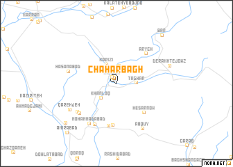
Chahār Bāgh (Khorāsān, Iran)Chahār Bāgh is a town in the Khorāsān region of Iran. An overview map of the region around Chahār Bāgh is displayed below.
regional and 3d topo map of Chahār Bāgh, Iran ::
Chahār Bāgh airports ::
The nearest airport is ASB - Ashkhabad Ashgabat, located 175.4 km north of Chahār Bāgh.
Nearby towns ::
Manqān (1.1km north west) //
Dāmanjān (2.8km north) //
Ţāghān (2.6km east) //
Khānloq (3.1km south west) //
Kārīzī (3.3km north) //
Ḩeşār Now (5.9km south east) //
Malakhdarreh (6.7km south) //
Aryeh (6.1km north east) //
Ḩoseynābād (6.9km south) //
Golshanābād (7.1km south west) //
Qālībāf-e Pā'īn (6.7km south west) //
Qālībāf-e Bālā (6.8km south west) //
Moḩammadābād (7.4km south west) //
Ḩasanābād (6.5km west) //
Ābqūy (8.0km south east) //
Qareh Jeh (7.4km south west) //
Derakht-e Jowz (7.5km east) //
Aḩmadābād (9.1km south west) //
Bār (9.8km north east) //
Amīrābād (10.1km south west) //
[all distances 'as the bird flies' and approximate] 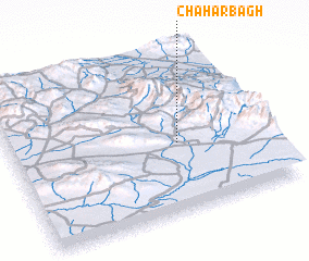 Places with similar names to Chahār Bāgh, Iran ::
// Chahār Bāgh (IR)
// Chahār Bāgh (IR)
// Chahār Bāgh (IR)
// Chahār Bāgh (IR)
// Chahār Bāgh (IR)
// Chahār Bāgh (IR)
// Chahār Bāgh (IR)
// Chahār Bāgh (IR)
// Chahār Bāgh (IR)
// Chahār Bāgh (IR)
Disclaimer :: Information on this page comes without warranty of any kind |
||
|
Where is Chahār Bāgh? Elevation and coordinates ::
Latitude (lat): 36°25'28"N Longitude (lon): 58°39'21"E
Elevation (approx.): 1424m (map arrows pan, magnifying glasses zoom) |
||
|
Visiting Chahār Bāgh? Hotel/Accommodation ::
Book a hotel in Chahār Bāgh Travel Guide ::
Buy a travel guide for Iran rental cars ::
car rental offers GPS waypoint ::
download a GPX waypoint (PoI) of Chahār Bāgh for your GPS receiver
|
||