|
search place name
|
||
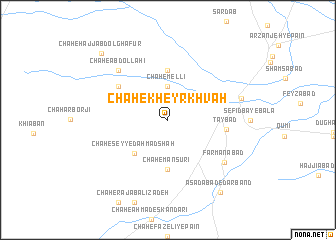
Chāh-e Kheyr Khvāh (Khorāsān, Iran)Chāh-e Kheyr Khvāh is a town in the Khorāsān region of Iran. An overview map of the region around Chāh-e Kheyr Khvāh is displayed below.
regional and 3d topo map of Chāh-e Kheyr Khvāh, Iran ::
Chāh-e Kheyr Khvāh airports ::
The nearest airport is HEA - Herat, located 151.2 km south east of Chāh-e Kheyr Khvāh.
Other airports nearby include XBJ - Birjand (245.4 km south west), Nearby towns ::
Chāh-e Mellī (3.7km north) //
Chāh-e Seyyed Aḩmad Shāh (4.8km south west) //
Chāh-e Manşūrī (5.6km south) //
Chāh Āqāmīr-e Bālā (5.6km north) //
Tāybād (5.5km east) //
Chāh-e Ḩājjī Āqāmīr-e Bālā (5.9km north west) //
Chāh-e ‘Abdollāhī (7.2km north west) //
Chāh-e Anşārī (7.2km north west) //
Farmānābād (7.0km south east) //
Kalāteh-ye Āqā (7.1km east) //
Asadābād-e Darband (9.4km south east) //
Chāh-e Ḩājj ‘Abd ol Ghafūr (9.6km north west) //
[all distances 'as the bird flies' and approximate] 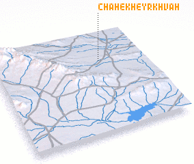 Places with similar names to Chāh-e Kheyr Khvāh, Iran :: Disclaimer :: Information on this page comes without warranty of any kind |
||
|
Where is Chāh-e Kheyr Khvāh? Elevation and coordinates ::
Latitude (lat): 34°45'0"N Longitude (lon): 60°43'0"E
Elevation (approx.): 863m (map arrows pan, magnifying glasses zoom) |
||
|
Visiting Chāh-e Kheyr Khvāh? Hotel/Accommodation ::
Book a hotel in Chāh-e Kheyr Khvāh Travel Guide ::
Buy a travel guide for Iran rental cars ::
car rental offers GPS waypoint ::
download a GPX waypoint (PoI) of Chāh-e Kheyr Khvāh for your GPS receiver
|
||