|
search place name
|
||
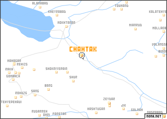
Chāh Tak (Khorāsān, Iran)Chāh Tak is a town in the Khorāsān region of Iran. An overview map of the region around Chāh Tak is displayed below.
regional and 3d topo map of Chāh Tak, Iran ::
Chāh Tak airports ::
The nearest airport is XBJ - Birjand, located 55.9 km north of Chāh Tak.
Nearby towns ::
Shokrī-ye Bālā (4.2km south west) //
Shūr (5.3km south) //
Shokrī-ye Pā'īn (5.9km south west) //
Mokhtārān (8.1km north west) //
Afdil (9.5km south west) //
Barg (9.5km south west) //
[all distances 'as the bird flies' and approximate] 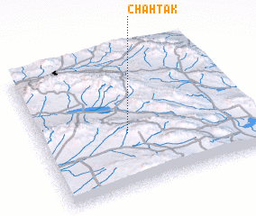 Places with similar names to Chāh Tak, Iran ::
// Shata Ga (MM)
// Shit-ka-aw (MM)
// Shitku (MM)
// Chetco (US)
// Chautauqua (US)
// Shattuc (US)
// Chautauqua (US)
// Chão de Gaia (PT)
// Chodak (PL)
// Chodaki (PL)
Disclaimer :: Information on this page comes without warranty of any kind |
||
|
Where is Chāh Tak? Elevation and coordinates ::
Latitude (lat): 32°24'39"N Longitude (lon): 59°25'13"E
Elevation (approx.): 1521m (map arrows pan, magnifying glasses zoom) |
||
|
Visiting Chāh Tak? Hotel/Accommodation ::
Book a hotel in Chāh Tak Travel Guide ::
Buy a travel guide for Iran rental cars ::
car rental offers GPS waypoint ::
download a GPX waypoint (PoI) of Chāh Tak for your GPS receiver
|
||