|
search place name
|
||
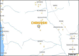
Chāh Voshī (Ostān-e Būshehr, Iran)Chāh Voshī is a town in the Ostān-e Būshehr region of Iran. An overview map of the region around Chāh Voshī is displayed below.
regional and 3d topo map of Chāh Voshī, Iran ::
Chāh Voshī airports ::
The nearest airport is BUZ - Bushehr, located 48.2 km north west of Chāh Voshī.
Other airports nearby include SYZ - Shiraz Shahid Dastghaib Intl (162.0 km north east), Nearby towns ::
Chāvoshī-ye Jonūbī (1.2km south) //
Chahleh (2.0km north east) //
Kolal-e Bālā (3.7km north) //
Kolal-e Pā'īn (4.1km north) //
Ālī Ḩoseynī (7.3km north) //
Derāzī (7.4km south) //
Bāgh-e Kamāl (9.1km south) //
[all distances 'as the bird flies' and approximate] 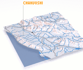 Places with similar names to Chāh Voshī, Iran ::
Disclaimer :: Information on this page comes without warranty of any kind |
||
|
Where is Chāh Voshī? Elevation and coordinates ::
Latitude (lat): 28°41'25"N Longitude (lon): 51°14'4"E
Elevation (approx.): 42m (map arrows pan, magnifying glasses zoom) |
||
|
Visiting Chāh Voshī? Hotel/Accommodation ::
Book a hotel in Chāh Voshī Travel Guide ::
Buy a travel guide for Iran rental cars ::
car rental offers GPS waypoint ::
download a GPX waypoint (PoI) of Chāh Voshī for your GPS receiver
|
||