|
search place name
|
||
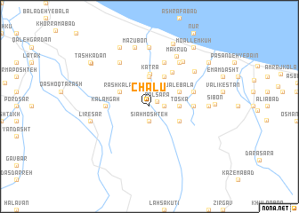
Chālū (Iran)Chālū is a town in Iran. An overview map of the region around Chālū is displayed below.
regional and 3d topo map of Chālū, Iran ::
Chālū airports ::
The nearest airport is RZR - Ramsar, located 37.0 km north west of Chālū.
Other airports nearby include THR - Teheran Mehrabad Intl (114.2 km south), RAS - Rasht (141.8 km north west), Nearby towns ::
Polsarā (1.0km north east) //
Sīāh Moshteh (1.9km south) //
Konūs Kūh (1.5km east) //
Mo‘allem Kūh (3.7km north) //
Kotī Bāzār (3.0km east) //
Toskā (3.0km east) //
Katrā (4.1km north) //
Rāsh Kalām (3.5km north west) //
Sefīdāb (3.5km south east) //
Jal-e Pā'īn (4.0km north) //
Rūdgar Maḩalleh (4.0km north) //
Jal-e Bālā (3.5km north east) //
Tūbon (4.8km north east) //
Kalāmgāh (4.5km west) //
Gāvsīr (4.5km east) //
Gowsar (4.5km east) //
Lūleh Deh (5.8km north) //
Band Bon (4.8km north east) //
Bandbon-e Qolī (4.8km north east) //
Māzūbon-e Soflá (6.3km north west) //
Palangābād-e Bālā (6.3km north east) //
Khoshkeh Būr (6.3km north east) //
Tameshkol (6.3km north east) //
Palangābād-e Pā'īn (6.6km north east) //
Mak Rūd (6.8km north east) //
Faqīhābād (6.3km north east) //
Ḩabībābād (7.4km north) //
Bījār (5.9km east) //
Māzūbon (7.6km north) //
[all distances 'as the bird flies' and approximate]  Places with similar names to Chālū, Iran ::
Disclaimer :: Information on this page comes without warranty of any kind |
||
|
Where is Chālū? Elevation and coordinates ::
Latitude (lat): 36°41'0"N Longitude (lon): 50°59'0"E
Elevation (approx.): 185m (map arrows pan, magnifying glasses zoom) |
||
|
Visiting Chālū? Hotel/Accommodation ::
Book a hotel in Chālū Travel Guide ::
Buy a travel guide for Iran rental cars ::
car rental offers GPS waypoint ::
download a GPX waypoint (PoI) of Chālū for your GPS receiver
|
||