|
search place name
|
||
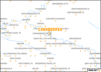
Cham Borreh (Lorestān, Iran)Cham Borreh is a town in the Lorestān region of Iran. An overview map of the region around Cham Borreh is displayed below.
regional and 3d topo map of Cham Borreh, Iran ::
Cham Borreh airports ::
The nearest airport is KSH - Bakhtaran Shahid Ashrafi Esfahani, located 141.2 km north west of Cham Borreh.
Other airports nearby include QMJ - Masjed Soleiman Shahid Asyaee (186.1 km south east), AWZ - Ahwaz (226.7 km south), SDG - Sanandaj (236.6 km north), Nearby towns ::
Jarqal‘eh (0.0km north) //
Āsemāndūl (0.0km north) //
Chūlhūl-e Mīān (1.5km west) //
Darreh Bāgh-e Dovvom (2.4km north west) //
Chūl Hūl (2.4km south east) //
Posht Melleh-ye Şeyd ‘Alī (2.4km south west) //
Cham Qabrestān (3.1km west) //
Kīvarkū (3.7km south) //
Dār Gel-e Kheyr‘alī (3.6km north east) //
Darreh Bāgh-e Moḩammad Ḩoseyn (4.0km north west) //
Chūlhūl-e Pāʼīn (3.6km north west) //
Choqāmīān-e Allāh Raḩīm (4.0km south east) //
Bīsheh Zardeh (4.0km south east) //
Āb Pedeh (3.6km south west) //
Darreh Derāz (3.6km south west) //
Tang-e Bardmīl (4.0km south west) //
Tappeh (4.8km north west) //
Darvāzeh-ye Sartakht (4.8km north west) //
Nūr ‘Alīvand Kār-e ‘Abd ol Ḩoseyn (4.8km south east) //
Dārdamel-e Ḩoseyn‘alī (4.8km south east) //
Zemgeh-ye Asad Koshteh (4.8km south east) //
Chenāreh-ye Shīrānī (5.8km north) //
Malīmdūl (5.0km east) //
Cham Bārīkeh (5.9km north west) //
Meleh-ye Posht-e Sar Takht (5.9km north west) //
Sartakht-e Qadam Kheyr (5.9km north west) //
Kolengkū (5.9km north west) //
Kelak Mīān-e ‘Alī Āqā Naz̧arī (6.4km north west) //
Cham Qamar (7.6km south) //
[all distances 'as the bird flies' and approximate] 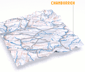 Places with similar names to Cham Borreh, Iran ::
Disclaimer :: Information on this page comes without warranty of any kind |
||
|
Where is Cham Borreh? Elevation and coordinates ::
Latitude (lat): 33°16'0"N Longitude (lon): 47°58'0"E
Elevation (approx.): 993m (map arrows pan, magnifying glasses zoom) |
||
|
Visiting Cham Borreh? Hotel/Accommodation ::
Book a hotel in Cham Borreh Travel Guide ::
Buy a travel guide for Iran rental cars ::
car rental offers GPS waypoint ::
download a GPX waypoint (PoI) of Cham Borreh for your GPS receiver
|
||