|
search place name
|
||
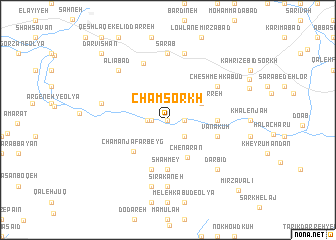
Cham Sorkh (Ostān-e Kermānshāh, Iran)Cham Sorkh is a town in the Ostān-e Kermānshāh region of Iran. An overview map of the region around Cham Sorkh is displayed below.
regional and 3d topo map of Cham Sorkh, Iran ::
Cham Sorkh airports ::
The nearest airport is KSH - Bakhtaran Shahid Ashrafi Esfahani, located 57.7 km west of Cham Sorkh.
Other airports nearby include SDG - Sanandaj (119.0 km north west), Nearby towns ::
Garūs-e ‘Olyā (0.0km north) //
Chenār-e Shovah (1.5km west) //
Kalān (1.5km east) //
Garūs-e Soflá (1.9km west) //
Kahrīz-e Kalān (2.4km south east) //
Bīdkholah (2.4km south east) //
Kalgā Darreh (3.6km north east) //
Chenārān (4.6km south east) //
Chaman Ja‘far Beyg (4.7km south west) //
Shāh Mey (5.6km south) //
Gol-e Zard (5.6km south) //
Chofteh Darreh (4.6km east) //
Vanākūh (4.9km east) //
Āqāmīr (5.8km south) //
Khoshk Ābkhowreh (5.9km north east) //
Cheshmeh Kabūd (5.9km north east) //
Bīd Sorkh (6.7km north) //
Sīrakāneh (7.4km south) //
Shādvalī (7.4km south) //
Sarāb (7.4km north) //
Ḩoseynkhān (7.6km south) //
‘Alīābād-e Garūs (6.4km west) //
Darreh-ye Marrān (7.6km north) //
Dārbīd (7.2km south east) //
‘Alīābād (7.2km north west) //
Darvīshān (9.6km north west) //
Mīrzā Valī (10.3km south east) //
[all distances 'as the bird flies' and approximate] 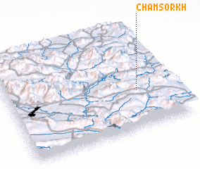 Places with similar names to Cham Sorkh, Iran ::
// Cham Zarak (IR)
Disclaimer :: Information on this page comes without warranty of any kind |
||
|
Where is Cham Sorkh? Elevation and coordinates ::
Latitude (lat): 34°23'0"N Longitude (lon): 47°47'0"E
Elevation (approx.): 1356m (map arrows pan, magnifying glasses zoom) |
||
|
Visiting Cham Sorkh? Hotel/Accommodation ::
Book a hotel in Cham Sorkh Travel Guide ::
Buy a travel guide for Iran rental cars ::
car rental offers GPS waypoint ::
download a GPX waypoint (PoI) of Cham Sorkh for your GPS receiver
|
||