|
search place name
|
||
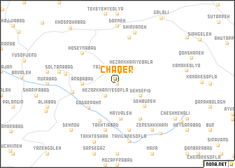
Chāqer (Hamadān, Iran)Chāqer is a town in the Hamadān region of Iran. An overview map of the region around Chāqer is displayed below.
regional and 3d topo map of Chāqer, Iran ::
Chāqer airports ::
The nearest airport is SDG - Sanandaj, located 86.6 km north west of Chāqer.
Other airports nearby include KSH - Bakhtaran Shahid Ashrafi Esfahani (87.1 km south west), Nearby towns ::
Deh-e Khazal (0.0km north) //
Hezār Khānī-ye Soflá (2.4km south west) //
Karsavān (2.4km north west) //
Cheshmeh Qareh (2.4km north east) //
Tāzehābād (2.4km north west) //
Hezār Khānī-ye Bālā (3.2km north east) //
Deh Sefīd (3.6km south east) //
‘Arabābād (4.6km west) //
Mayvaleh (5.5km south) //
Deh Būreh (5.1km south east) //
Godār Pahn (5.3km south west) //
Ḩoseynābād (6.3km south) //
Keynī Sāyeh (6.3km south east) //
Āfarīānaj (6.1km west) //
Ḩoseynābād (6.7km north west) //
Rostamābād (7.6km south) //
Takhtīābād (7.6km south) //
Qūrmeh Darreh (7.6km north) //
Chowgān (6.9km west) //
Shīrvāneh (8.5km north) //
Zereshk Khānī (8.7km south east) //
Ţavīlān-e ‘Olyā (9.7km south east) //
Dehnow (9.6km south west) //
[all distances 'as the bird flies' and approximate]  Places with similar names to Chāqer, Iran ::
Disclaimer :: Information on this page comes without warranty of any kind |
||
|
Where is Chāqer? Elevation and coordinates ::
Latitude (lat): 34°53'0"N Longitude (lon): 47°51'0"E
Elevation (approx.): 2041m (map arrows pan, magnifying glasses zoom) |
||
|
Visiting Chāqer? Hotel/Accommodation ::
Book a hotel in Chāqer Travel Guide ::
Buy a travel guide for Iran rental cars ::
car rental offers GPS waypoint ::
download a GPX waypoint (PoI) of Chāqer for your GPS receiver
|
||