|
search place name
|
||
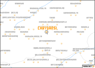
Chāy Darsī (Ostān-e Āz̄arbāyjān-e Gharbī, Iran)Chāy Darsī is a town in the Ostān-e Āz̄arbāyjān-e Gharbī region of Iran. An overview map of the region around Chāy Darsī is displayed below.
regional and 3d topo map of Chāy Darsī, Iran ::
Chāy Darsī airports ::
The nearest airport is TBZ - Tabriz Intl, located 156.9 km north west of Chāy Darsī.
Other airports nearby include SDG - Sanandaj (194.2 km south), Nearby towns ::
Qareh Gonbad-e ‘Olyā (1.9km north) //
Qareh Valī (2.4km north east) //
Bāghlūjeh (2.4km north west) //
Cher Cherā (3.0km east) //
Qayeh Qorbān Shīr (3.7km south) //
Qarah Dāsh (3.7km north) //
Pīr ‘Azīz (3.5km north east) //
Khandaq (4.0km north) //
Qarah Gonbad-e Soflá (4.7km north east) //
Morādkhān Kandī (4.4km east) //
Takān (5.8km north) //
Khvājehlar-e ‘Olyā (4.8km south west) //
Zarrīn Deh (4.8km north west) //
Davah Yātāqī (5.8km south east) //
Āq Bolāgh-e Kūrānlū (6.7km south) //
Qūzlū (7.4km south) //
Khvājehlar-e Vosţá (6.2km west) //
Khvājehlar-e Soflá (6.2km west) //
Ānā Bolāghī (6.2km west) //
Bārūt Āghājī (8.6km south east) //
Pīr Qolī (8.6km north west) //
[all distances 'as the bird flies' and approximate]  Places with similar names to Chāy Darsī, Iran ::
// Shotaryz (AZ)
// Shtrazë (AL)
// Shtrez (AL)
// Shtrezë (AL)
// Chetriş (RO)
// Chetrosu (RO)
// Chetrosu (RO)
// Chāh Darāz (IR)
// Chah Derāz (IR)
// Chāh Derāz (IR)
Disclaimer :: Information on this page comes without warranty of any kind |
||
|
Where is Chāy Darsī? Elevation and coordinates ::
Latitude (lat): 36°59'0"N Longitude (lon): 47°16'0"E
Elevation (approx.): 2093m (map arrows pan, magnifying glasses zoom) |
||
|
Visiting Chāy Darsī? Hotel/Accommodation ::
Book a hotel in Chāy Darsī Travel Guide ::
Buy a travel guide for Iran rental cars ::
car rental offers GPS waypoint ::
download a GPX waypoint (PoI) of Chāy Darsī for your GPS receiver
|
||