|
search place name
|
||
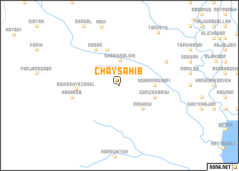
Chāy Sahīb (Khūzestān, Iran)Chāy Sahīb is a town in the Khūzestān region of Iran. An overview map of the region around Chāy Sahīb is displayed below.
regional and 3d topo map of Chāy Sahīb, Iran ::
Chāy Sahīb airports ::
The nearest airport is AWZ - Ahwaz, located 100.9 km south east of Chāy Sahīb.
Other airports nearby include QMJ - Masjed Soleiman Shahid Asyaee (110.7 km east), BSR - Basrah Intl (171.6 km south), ABD - Abadan (186.5 km south), MRX - Bandar Mahshahr Mahshahr (193.5 km south east), Nearby towns ::
Fa‘īl Zomod (2.5km north west) //
Shahīd Şāleḩī (3.9km north) //
Rāshedī (4.9km south east) //
Moḩammad Şāfī (4.7km east) //
Gorīz-e Karīdī (5.1km east) //
Kheẕr (5.8km north) //
Rasan (6.4km north west) //
‘Ashīreh-ye Zāmel (5.7km west) //
Maḩāreb (6.6km west) //
Ghashā va Shīryūl (7.3km north east) //
Tarveyd (9.8km north east) //
[all distances 'as the bird flies' and approximate]  Places with similar names to Chāy Sahīb, Iran ::
// Chāh Sāhibu (PK)
// Shazhouba (CN)
Disclaimer :: Information on this page comes without warranty of any kind |
||
|
Where is Chāy Sahīb? Elevation and coordinates ::
Latitude (lat): 32°3'0"N Longitude (lon): 48°6'0"E
Elevation (approx.): 109m (map arrows pan, magnifying glasses zoom) |
||
|
Visiting Chāy Sahīb? Hotel/Accommodation ::
Book a hotel in Chāy Sahīb Travel Guide ::
Buy a travel guide for Iran rental cars ::
car rental offers GPS waypoint ::
download a GPX waypoint (PoI) of Chāy Sahīb for your GPS receiver
|
||