|
search place name
|
||
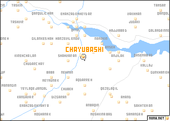
Chāy Ūbāshī (Iran)Chāy Ūbāshī is a town in Iran. An overview map of the region around Chāy Ūbāshī is displayed below.
regional and 3d topo map of Chāy Ūbāshī, Iran ::
Chāy Ūbāshī airports ::
The nearest airport is RAS - Rasht, located 78.8 km north east of Chāy Ūbāshī.
Other airports nearby include RZR - Ramsar (138.2 km east), Nearby towns ::
Āltīn Kosh (1.4km north west) //
Ma‘dan (2.4km north east) //
Qameshak (3.0km west) //
Shāhvarān (3.0km west) //
Harzevīl-e Now (4.8km north west) //
Namakīn (4.8km north east) //
Nehrān (4.8km south west) //
Āq Darreh (5.6km south) //
Kashkevar (5.6km north) //
Kanseh (4.8km north east) //
Qezel Ḩeşār (4.8km south east) //
Qīţūl (5.8km north) //
Hend Zamīn (5.8km north) //
Shāh Meydān (7.4km north) //
Meydān-e Moţahharī (7.4km north) //
Anjīlak (5.9km east) //
Cholombeh (7.4km south) //
Shīr Dasht (7.6km north) //
Qareh Cham (7.6km north) //
Emāmzādeh Qāsem (6.2km east) //
Moḩammadābād (8.0km north) //
Chūbeh (8.0km south) //
Chīlān Kasheh (7.0km north west) //
Bābā (7.0km south west) //
Gīlvān (8.8km north) //
Meymūnak (8.1km south west) //
Bahrāmābād (8.1km north east) //
Ḩājjīābād (8.1km north east) //
Qezel ‘Aqīl (8.7km south east) //
[all distances 'as the bird flies' and approximate] 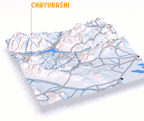 Places with similar names to Chāy Ūbāshī, Iran :: Disclaimer :: Information on this page comes without warranty of any kind |
||
|
Where is Chāy Ūbāshī? Elevation and coordinates ::
Latitude (lat): 36°43'0"N Longitude (lon): 49°9'0"E
Elevation (approx.): 574m (map arrows pan, magnifying glasses zoom) |
||
|
Visiting Chāy Ūbāshī? Hotel/Accommodation ::
Book a hotel in Chāy Ūbāshī Travel Guide ::
Buy a travel guide for Iran rental cars ::
car rental offers GPS waypoint ::
download a GPX waypoint (PoI) of Chāy Ūbāshī for your GPS receiver
|
||