|
search place name
|
||
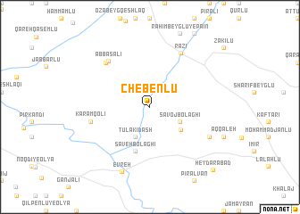
Chebenlū (Iran)Chebenlū is a town in Iran. An overview map of the region around Chebenlū is displayed below.
regional and 3d topo map of Chebenlū, Iran ::
Chebenlū airports ::
The nearest airport is TBZ - Tabriz Intl, located 167.2 km west of Chebenlū.
Other airports nearby include RAS - Rasht (193.1 km south east), BAK - Baku Heydar Aliyev (271.1 km north east), Nearby towns ::
Sāvoj Bolāghī (3.4km south east) //
Tūlakī Dāsh (4.0km south) //
Tūlaī Dāsh (4.0km south) //
Chebenlū-ye Qeshlāq (4.1km south east) //
Sāveh Bolāghī (5.7km south) //
Sa‘ādat Bolāghī (5.7km south) //
Karam Qolī (6.1km west) //
‘Abbās‘alī (7.0km north west) //
Raẕī (7.4km north east) //
Ḩasanlū (7.1km north west) //
Chāvoshān (6.9km south east) //
Ţahmāsebābād (6.9km south east) //
Evreh (8.6km south) //
Ḩeydarābād (10.0km south east) //
[all distances 'as the bird flies' and approximate]  Places with similar names to Chebenlū, Iran ::
Disclaimer :: Information on this page comes without warranty of any kind |
||
|
Where is Chebenlū? Elevation and coordinates ::
Latitude (lat): 38°34'0"N Longitude (lon): 48°4'0"E
Elevation (approx.): 1295m (map arrows pan, magnifying glasses zoom) |
||
|
Visiting Chebenlū? Hotel/Accommodation ::
Book a hotel in Chebenlū Travel Guide ::
Buy a travel guide for Iran rental cars ::
car rental offers GPS waypoint ::
download a GPX waypoint (PoI) of Chebenlū for your GPS receiver
|
||