|
search place name
|
||
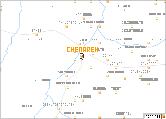
Chenāreh (Kordestān, Iran)Chenāreh is a town in the Kordestān region of Iran. An overview map of the region around Chenāreh is displayed below.
regional and 3d topo map of Chenāreh, Iran ::
Chenāreh airports ::
The nearest airport is SDG - Sanandaj, located 108.0 km south of Chenāreh.
Other airports nearby include KSH - Bakhtaran Shahid Ashrafi Esfahani (207.3 km south), TBZ - Tabriz Intl (222.1 km north), Nearby towns ::
Khāneh Mīrān (1.5km west) //
Nūrābād (2.4km south east) //
Shāshā (2.4km south east) //
Santeh (2.4km north west) //
Chāpān-e ‘Olyā (2.3km north east) //
Sonnateh (3.6km north) //
Īnchekeh (3.7km north) //
Seyfābād (4.0km south) //
Chāpān-e Soflá (4.8km north east) //
Sheykh ‘Alī (4.8km south west) //
Qowkh (4.5km east) //
Tamer Beyg (5.8km south east) //
Darreh Qebleh (6.9km south west) //
Jonīyān (6.3km east) //
Qareh Gol-e Qūkh (7.6km north) //
Ẕāmenābād (7.0km south east) //
‘Alīābād (8.0km south) //
Golzār-e Soflá (8.0km north) //
Maḩmūdābād (8.0km north) //
Takht (9.5km south east) //
[all distances 'as the bird flies' and approximate] 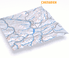 Places with similar names to Chenāreh, Iran ::
Disclaimer :: Information on this page comes without warranty of any kind |
||
|
Where is Chenāreh? Elevation and coordinates ::
Latitude (lat): 36°9'0"N Longitude (lon): 46°34'0"E
Elevation (approx.): 1532m (map arrows pan, magnifying glasses zoom) |
||
|
Visiting Chenāreh? Hotel/Accommodation ::
Book a hotel in Chenāreh Travel Guide ::
Buy a travel guide for Iran rental cars ::
car rental offers GPS waypoint ::
download a GPX waypoint (PoI) of Chenāreh for your GPS receiver
|
||