|
search place name
|
||
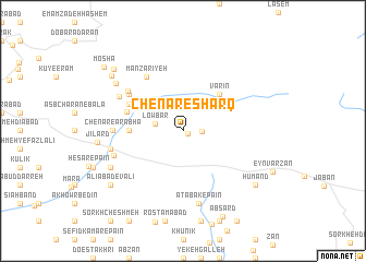
Chenār-e Sharq (Tehrān, Iran)Chenār-e Sharq is a town in the Tehrān region of Iran. An overview map of the region around Chenār-e Sharq is displayed below.
regional and 3d topo map of Chenār-e Sharq, Iran ::
Chenār-e Sharq airports ::
The nearest airport is THR - Teheran Mehrabad Intl, located 72.7 km west of Chenār-e Sharq.
Other airports nearby include RZR - Ramsar (186.2 km north west), Nearby towns ::
Gol Gangag (0.5km south east) //
Ashteh Dar (1.6km east) //
Lowbar (2.4km west) //
Varīn (4.8km north east) //
Valīrān (4.5km west) //
Damāvand (5.1km north west) //
Rūḩafzā (5.3km north west) //
Dasht-e Mazār (5.8km north west) //
Manz̧arīyeh (6.3km north west) //
Ovreh (6.1km north west) //
Chenār-e ‘Arabhā (5.8km west) //
Aḩmadābād (6.4km north west) //
Atābak-e Pā'īn (7.5km south) //
Kāl Dasht-e Bālā (6.3km south west) //
Kāl Dasht-e Pā'īn (6.3km west) //
Shalambeh (6.3km west) //
Qarā'ī (7.1km south west) //
Vozon Darreh (7.1km south west) //
Soltān Darreh-ye Pā'īn (7.1km south west) //
Dashtbān (7.4km north west) //
Jīlārd (7.2km west) //
Cheshmeh A‘lā (8.2km north west) //
Hūmand (8.2km south east) //
‘Alīābād-e Vālī (8.2km south west) //
Soltān Darreh-ye Bālā (8.2km south west) //
Dashtak (8.5km north west) //
Āb Sard (9.3km south) //
Moshā (9.2km north west) //
[all distances 'as the bird flies' and approximate] 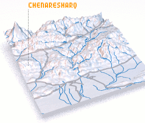 Places with similar names to Chenār-e Sharq, Iran :: Disclaimer :: Information on this page comes without warranty of any kind |
||
|
Where is Chenār-e Sharq? Elevation and coordinates ::
Latitude (lat): 35°42'0"N Longitude (lon): 52°7'0"E
Elevation (approx.): 2238m (map arrows pan, magnifying glasses zoom) |
||
|
Visiting Chenār-e Sharq? Hotel/Accommodation ::
Book a hotel in Chenār-e Sharq Travel Guide ::
Buy a travel guide for Iran rental cars ::
car rental offers GPS waypoint ::
download a GPX waypoint (PoI) of Chenār-e Sharq for your GPS receiver
|
||