|
search place name
|
||
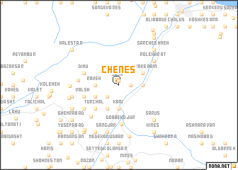
Chenes (Iran)Chenes is a town in Iran. An overview map of the region around Chenes is displayed below.
regional and 3d topo map of Chenes, Iran ::
Chenes airports ::
The nearest airport is RZR - Ramsar, located 70.7 km north west of Chenes.
Other airports nearby include THR - Teheran Mehrabad Intl (95.5 km south), RAS - Rasht (176.3 km north west), Nearby towns ::
Samāʼ (0.6km north) //
Jūrū (1.5km east) //
Tūlak (2.4km south west) //
Kānī (3.7km south) //
Pol-e Z̄oghāl (3.7km south) //
Rāveh (3.0km west) //
Levarchāl (3.0km west) //
Azārak-e Bālā (3.0km east) //
Bīrī (4.0km south) //
Ozār (3.5km south west) //
Valasht (3.5km south west) //
Nargesān (3.5km south west) //
Solţān Sar (3.5km north east) //
Azārak-e Pā'īn (3.5km north east) //
Magas Khānī (3.5km north east) //
Tūrchāl (4.8km south west) //
Valsh (4.8km south west) //
Dīmū (4.8km north west) //
Do Āb-e Kojūr (6.2km south) //
Samā' (5.2km west) //
Sanār-e Pā'īn (6.1km south west) //
Sanār-e Bālā (5.8km south west) //
Moḩammadābād (5.8km north east) //
Moḩammadābād-e Polkarāt (5.8km north east) //
Pol-e Karāt (5.8km north east) //
Chalājūr (6.2km west) //
Sangjār (7.6km south) //
La‘l-e Bījār (7.6km south) //
Sarkā' (6.3km west) //
[all distances 'as the bird flies' and approximate] 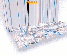 Places with similar names to Chenes, Iran ::
Disclaimer :: Information on this page comes without warranty of any kind |
||
|
Where is Chenes? Elevation and coordinates ::
Latitude (lat): 36°33'0"N Longitude (lon): 51°20'0"E
Elevation (approx.): 1267m (map arrows pan, magnifying glasses zoom) |
||
|
Visiting Chenes? Hotel/Accommodation ::
Book a hotel in Chenes Travel Guide ::
Buy a travel guide for Iran rental cars ::
car rental offers GPS waypoint ::
download a GPX waypoint (PoI) of Chenes for your GPS receiver
|
||