|
search place name
|
||
Cheshmeh Qolī (Kordestān, Iran)Cheshmeh Qolī is a town in the Kordestān region of Iran. An overview map of the region around Cheshmeh Qolī is displayed below.
regional and 3d topo map of Cheshmeh Qolī, Iran ::

Cheshmeh Qolī airports ::
The nearest airport is SDG - Sanandaj, located 63.4 km south west of Cheshmeh Qolī.
Other airports nearby include KSH - Bakhtaran Shahid Ashrafi Esfahani (147.7 km south), Nearby towns ::
Qerekhlar (3.9km south west) //
Cheshmeh Mantash (4.8km south west) //
Şādeqābād (5.3km east) //
Zarrīn Chūb (6.2km south west) //
Khūdelān (7.7km south) //
Zarrīnābād (7.3km south east) //
Shahrak-e Soflá (7.5km south west) //
Qeshlāq-e Now Rūz (8.7km north west) //
Moḩammadābād-e Nīl (8.4km south west) //
Sabzevār (9.1km north east) //
[all distances 'as the bird flies' and approximate] 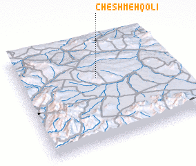 Places with similar names to Cheshmeh Qolī, Iran ::
// Cheshmeh Gol (IR)
// Cheshmeh Gol (IR)
// Cheshmeh Gol (IR)
// Cheshmeh Gol (IR)
// Cheshmeh Golī (IR)
// Cheshmeh Kolā (IR)
// Chichimequilla (MX)
// Chichimequilla (MX)
// Chashmaikulo (TJ)
// Cheshmeh Qal‘eh (IR)
Disclaimer :: Information on this page comes without warranty of any kind |
||
|
Where is Cheshmeh Qolī? Elevation and coordinates ::
Latitude (lat): 35°38'44"N Longitude (lon): 47°30'29"E
Elevation (approx.): 1841m (map arrows pan, magnifying glasses zoom) |
||
|
Visiting Cheshmeh Qolī? Hotel/Accommodation ::
Book a hotel in Cheshmeh Qolī Travel Guide ::
Buy a travel guide for Iran rental cars ::
car rental offers GPS waypoint ::
download a GPX waypoint (PoI) of Cheshmeh Qolī for your GPS receiver
|
||