|
search place name
|
||
Cheshmeh Sanjās (Fārs, Iran)Cheshmeh Sanjās is a town in the Fārs region of Iran. An overview map of the region around Cheshmeh Sanjās is displayed below.
regional and 3d topo map of Cheshmeh Sanjās, Iran ::

Cheshmeh Sanjās airports ::
The nearest airport is SYZ - Shiraz Shahid Dastghaib Intl, located 168.6 km south east of Cheshmeh Sanjās.
Other airports nearby include BUZ - Bushehr (183.1 km south), Nearby towns ::
Darreh-ye Senjās (0.9km north west) //
Dasht (1.5km south west) //
Kat (1.6km east) //
Kangarestān (1.9km north) //
Senjās (1.9km west) //
Mīdjān (2.9km east) //
Āb Gerdū (3.1km west) //
Nīnehvand (3.1km west) //
Nakhjīrgāh (3.4km south east) //
Sarkerm (4.1km north west) //
Garkūshk (4.3km south) //
Tang Jūk (4.6km south) //
Ţāsak (4.8km south east) //
Sar Ţāveh (4.9km north east) //
Deh-e Mīrzā ‘Alī (4.9km south east) //
Donbīldān (4.9km south east) //
Khīkandeh (4.9km south west) //
Balūţ-e Asadī (5.0km north west) //
Cheshmeh Khīkandeh (4.9km west) //
Tang-e Gojestān (5.7km south) //
Sar-e Chāh (5.2km east) //
Kal-e Ābtāk (6.1km north) //
Gorjestān (6.1km south) //
Tīneh Vand (5.5km west) //
Pehūn (7.1km south east) //
Shīrkhvosī-ye Bālā (7.5km south) //
Tang-e Chūg (6.6km west) //
Mollā-ye Sefīd (7.4km south east) //
Sīratī (7.4km south east) //
[all distances 'as the bird flies' and approximate] 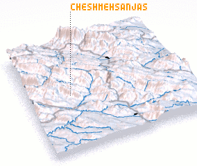 Places with similar names to Cheshmeh Sanjās, Iran :: Disclaimer :: Information on this page comes without warranty of any kind |
||
|
Where is Cheshmeh Sanjās? Elevation and coordinates ::
Latitude (lat): 30°33'0"N Longitude (lon): 51°16'58"E
Elevation (approx.): 1788m (map arrows pan, magnifying glasses zoom) |
||
|
Visiting Cheshmeh Sanjās? Hotel/Accommodation ::
Book a hotel in Cheshmeh Sanjās Travel Guide ::
Buy a travel guide for Iran rental cars ::
car rental offers GPS waypoint ::
download a GPX waypoint (PoI) of Cheshmeh Sanjās for your GPS receiver
|
||