|
search place name
|
||
Cheshmeh-ye Shūr (Khorāsān, Iran)Cheshmeh-ye Shūr is a town in the Khorāsān region of Iran. An overview map of the region around Cheshmeh-ye Shūr is displayed below.
regional and 3d topo map of Cheshmeh-ye Shūr, Iran ::

Cheshmeh-ye Shūr airports ::
The nearest airport is XBJ - Birjand, located 14.0 km south of Cheshmeh-ye Shūr.
Nearby towns ::
Posūch (0.7km south west) //
Pīronj (2.1km north) //
Esmā‘īlābād (2.4km north east) //
Andaneg-e Bālā (2.4km north west) //
Ḩājj Javād (2.4km south west) //
Ḩājjīābād (3.0km south east) //
Kalāteh-ye Mūsá (3.6km north) //
Mahīābād (3.4km south west) //
Pā Morgh (3.2km west) //
Razg (4.0km north west) //
Kūshk (5.1km north) //
Gūr Gaz-e Bālā (4.4km west) //
Rāz (4.8km north west) //
Kalāteh-ye Now (4.9km north west) //
Darreh Bāghān (5.6km north) //
Cheshmeh-ye Morgh (4.7km west) //
Karīmābād (5.5km south west) //
Mū Gerd (5.9km north) //
Eshkambarābād (6.3km south west) //
Kalāteh-ye Ḩājjī Moḩammad Moḩsen (6.4km south west) //
Qolleh-ye Āsekī (6.7km north) //
Cheshmeh-ye Khākī (6.2km east) //
Kūr Gaz-e Bālā (6.2km west) //
Kalāteh-ye Ākhvond (7.4km south) //
Taqūk (6.5km east) //
Bakān (6.5km west) //
Dīnūk (7.3km north east) //
Qambarūk (7.3km north east) //
Bojd (7.8km south) //
[all distances 'as the bird flies' and approximate] 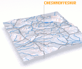 Places with similar names to Cheshmeh-ye Shūr, Iran ::
Disclaimer :: Information on this page comes without warranty of any kind |
||
|
Where is Cheshmeh-ye Shūr? Elevation and coordinates ::
Latitude (lat): 33°1'0"N Longitude (lon): 59°19'0"E
Elevation (approx.): 1829m (map arrows pan, magnifying glasses zoom) |
||
|
Visiting Cheshmeh-ye Shūr? Hotel/Accommodation ::
Book a hotel in Cheshmeh-ye Shūr Travel Guide ::
Buy a travel guide for Iran rental cars ::
car rental offers GPS waypoint ::
download a GPX waypoint (PoI) of Cheshmeh-ye Shūr for your GPS receiver
|
||