|
search place name
|
||
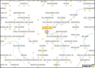
Dāghī (Ostān-e Āz̄arbāyjān-e Sharqī, Iran)Dāghī is a town in the Ostān-e Āz̄arbāyjān-e Sharqī region of Iran. An overview map of the region around Dāghī is displayed below.
regional and 3d topo map of Dāghī, Iran ::
Dāghī airports ::
The nearest airport is TBZ - Tabriz Intl, located 108.1 km north west of Dāghī.
Nearby towns ::
Chabānlū (0.0km north) //
Āqājān Kandī (1.5km east) //
Qūrt Qayah Sī (2.4km south west) //
Āqbolāgh (2.4km south west) //
Āsāyesh (2.4km north west) //
Qūyūjūq (2.4km north east) //
Goshāyesh (2.9km west) //
Qamar Kandī (3.7km south) //
Talam Khān (3.7km north) //
Qarājeh Qayah (4.0km south) //
Tāzeh Kand-e Qezel Dāgh (3.5km south east) //
Āz̄ar Pasand (4.7km north east) //
Qerkh Seqer (4.4km east) //
Yelah Qārshū (5.6km north) //
Qezel Dāgh (4.8km south east) //
Gerāmī (5.8km south) //
Beyg Kandī (5.8km south) //
Valī Kandī (5.8km south west) //
Mollā Jīq (6.3km north west) //
Īstgāh-e Hashtrūd (5.8km north east) //
Gūbak Tappeh (6.2km west) //
Nīāz Kandī (7.6km south) //
Bābā Gar Gar (6.2km west) //
Shekar Bolāghī (7.6km north) //
Qaţānqū (7.1km north east) //
Takānlū-ye Soflá (7.1km south east) //
Z̄ū ol Qadr (7.0km north west) //
Īstgāh-e Ātash Beyg (7.0km north west) //
Laklar (8.1km north west) //
[all distances 'as the bird flies' and approximate]  Places with similar names to Dāghī, Iran ::
Disclaimer :: Information on this page comes without warranty of any kind |
||
|
Where is Dāghī? Elevation and coordinates ::
Latitude (lat): 37°17'0"N Longitude (lon): 46°50'0"E
Elevation (approx.): 1743m (map arrows pan, magnifying glasses zoom) |
||
|
Visiting Dāghī? Hotel/Accommodation ::
Book a hotel in Dāghī Travel Guide ::
Buy a travel guide for Iran rental cars ::
car rental offers GPS waypoint ::
download a GPX waypoint (PoI) of Dāghī for your GPS receiver
|
||