|
search place name
|
||
Danbeh-ye Pā'īn (Eşfahān, Iran)Danbeh-ye Pā'īn is a town in the Eşfahān region of Iran. An overview map of the region around Danbeh-ye Pā'īn is displayed below.
regional and 3d topo map of Danbeh-ye Pā'īn, Iran ::
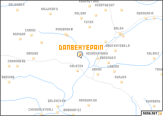
Nearby towns ::
Kalāteh (3.1km south) //
Ḩeşār Khāmeh (3.0km east) //
Hapān (4.8km south east) //
Namakeh (5.9km north west) //
Āb Rendān (5.1km east) //
Pīr Ebrāhīm (6.3km north west) //
Emāmzādeh Moḩammad (5.8km north east) //
Tūyeh (7.4km north) //
Kalā Būneh-ye Bālā (6.5km east) //
Labvān (6.8km south east) //
Qal‘eh (9.0km north east) //
[all distances 'as the bird flies' and approximate] 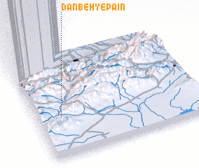 Places with similar names to Danbeh-ye Pā'īn, Iran ::
// Donbeh-ye Pā'īn (IR)
Disclaimer :: Information on this page comes without warranty of any kind |
||
|
Where is Danbeh-ye Pā'īn? Elevation and coordinates ::
Latitude (lat): 36°23'0"N Longitude (lon): 54°9'0"E
Elevation (approx.): 1759m (map arrows pan, magnifying glasses zoom) |
||
|
Visiting Danbeh-ye Pā'īn? Hotel/Accommodation ::
Book a hotel in Danbeh-ye Pā'īn Travel Guide ::
Buy a travel guide for Iran rental cars ::
car rental offers GPS waypoint ::
download a GPX waypoint (PoI) of Danbeh-ye Pā'īn for your GPS receiver
|
||