|
search place name
|
||
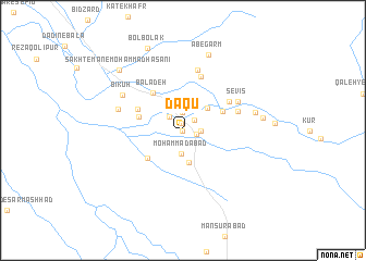
Daqū (Fārs, Iran)Daqū is a town in the Fārs region of Iran. An overview map of the region around Daqū is displayed below.
regional and 3d topo map of Daqū, Iran ::
Daqū airports ::
The nearest airport is SYZ - Shiraz Shahid Dastghaib Intl, located 68.5 km north east of Daqū.
Other airports nearby include BUZ - Bushehr (115.3 km west), Nearby towns ::
Ḩoseynābād (0.0km north) //
Bīdkān-e Khān Neshīn (0.7km north) //
Ḩasanābād-e Pā'īn (0.7km north) //
Jereh (1.3km east) //
Khorramzār (1.5km north east) //
Deh Now (1.6km east) //
Qaşr-e ‘Alī (1.9km north) //
Īlān (1.9km north west) //
Moḩammadābād (2.4km south) //
Zarrīn Kūyeh (2.7km north) //
Bāgh Dasht (3.3km south) //
Javālīqān (3.2km north east) //
Ḩasanābād-e Bālā (4.1km north east) //
Bīdkān (4.2km south west) //
Tall-e Gāv (4.2km west) //
Bālā Deh (4.6km north west) //
Tall-e Bīz (4.6km north west) //
Serīzjān (5.1km north east) //
Amlāk (5.8km north) //
Gīkh (5.3km east) //
Abū ol Ḩasanī (6.3km north) //
Sevīs (5.7km north east) //
Jadval-e Torkī (6.2km west) //
Bīkūh (6.5km north west) //
Sheykh (6.7km east) //
Āb-e Garm (8.2km north) //
Kānrūd (7.2km east) //
Sākhtemān-e Moḩammad Ḩasanī (8.4km north west) //
Bolbolak (9.0km north) //
[all distances 'as the bird flies' and approximate] 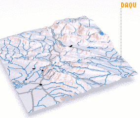 Places with similar names to Daqū, Iran ::
Disclaimer :: Information on this page comes without warranty of any kind |
||
|
Where is Daqū? Elevation and coordinates ::
Latitude (lat): 29°15'0"N Longitude (lon): 51°58'0"E
Elevation (approx.): 777m (map arrows pan, magnifying glasses zoom) |
||
|
Visiting Daqū? Hotel/Accommodation ::
Book a hotel in Daqū Travel Guide ::
Buy a travel guide for Iran rental cars ::
car rental offers GPS waypoint ::
download a GPX waypoint (PoI) of Daqū for your GPS receiver
|
||