|
search place name
|
||
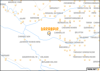
Dārāb Pīr (Lorestān, Iran)Dārāb Pīr is a town in the Lorestān region of Iran. An overview map of the region around Dārāb Pīr is displayed below.
regional and 3d topo map of Dārāb Pīr, Iran ::
Dārāb Pīr airports ::
The nearest airport is KSH - Bakhtaran Shahid Ashrafi Esfahani, located 45.3 km north west of Dārāb Pīr.
Other airports nearby include SDG - Sanandaj (138.8 km north), Nearby towns ::
Sargar-e Nād‘alī (1.9km north) //
Cham Anjīr (3.1km east) //
Benjufeyẕ-e Soflá (3.1km east) //
Sālār Dūl (3.2km east) //
Benjūfeyẕ-e ‘Olyā (3.6km north east) //
Būrbūrā-ye Vosţá (3.6km north east) //
Garhīmkah (3.6km north east) //
Tūdār (3.6km north east) //
Khalīlābād (4.8km south east) //
Sormeh (4.8km east) //
Qeshlāq-e Bāgh Kerah (5.0km east) //
Bāgh Kerah (5.0km east) //
Būrbūr-e ‘Olyā (5.9km north east) //
Sharafābād-e Pā'īn (6.4km north east) //
Darreh-ye Khodāmorād (6.4km north east) //
Cheleh Khāneh (6.6km north west) //
Bālāndar-e Soflá (6.9km north east) //
Chenār (6.8km north west) //
Shūrzeh (7.4km north) //
Pashkaleh-ye Pā'īn (7.4km north) //
Pashmaleh (7.6km north) //
Cherāghābād (7.6km north) //
Cheshmeh Khānī (6.4km east) //
Qeshlāq-e Tahsarān (6.4km east) //
Gāvdāneh Pā (6.4km east) //
Pashkaleh-ye Bālā (7.6km north) //
Shekar ‘Alī (7.2km south east) //
Şafarkhān-e Naz̧arkhān (7.2km south east) //
Cheshmeh Kūzān (7.2km north east) //
[all distances 'as the bird flies' and approximate] 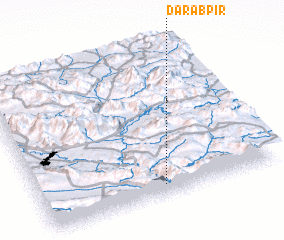 Places with similar names to Dārāb Pīr, Iran :: Disclaimer :: Information on this page comes without warranty of any kind |
||
|
Where is Dārāb Pīr? Elevation and coordinates ::
Latitude (lat): 34°4'0"N Longitude (lon): 47°31'0"E
Elevation (approx.): 1486m (map arrows pan, magnifying glasses zoom) |
||
|
Visiting Dārāb Pīr? Hotel/Accommodation ::
Book a hotel in Dārāb Pīr Travel Guide ::
Buy a travel guide for Iran rental cars ::
car rental offers GPS waypoint ::
download a GPX waypoint (PoI) of Dārāb Pīr for your GPS receiver
|
||