|
search place name
|
||
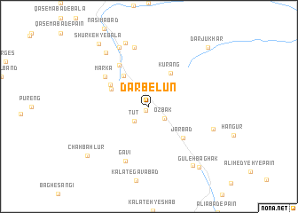
Darb-e Lūn (Khorāsān, Iran)Darb-e Lūn is a town in the Khorāsān region of Iran. An overview map of the region around Darb-e Lūn is displayed below.
regional and 3d topo map of Darb-e Lūn, Iran ::
Darb-e Lūn airports ::
The nearest airport is XBJ - Birjand, located 129.6 km west of Darb-e Lūn.
Other airports nearby include HEA - Herat (248.6 km north east), Nearby towns ::
Dālūn (0.6km south west) //
Ozbak (2.2km south east) //
Tūt (2.4km south west) //
Lānū (3.3km north west) //
Kūrang (4.7km north east) //
‘Abbāsābād (4.7km north west) //
Tajeshg (4.5km north west) //
Tejeshk (4.6km north west) //
Markeh (5.0km north west) //
Jarbād (5.4km south east) //
Dahaneh-ye Tangal (6.0km north west) //
Mārkā (6.0km north west) //
Gavī (7.3km south) //
Nowdeh-e Pā'īn (7.6km north) //
Nowdeh-e Bālā (8.0km north west) //
Derakht-e Tūt (8.4km north) //
Bīsheh (7.4km south east) //
Shūr-e Pāʼīn (8.2km north west) //
Galū Bāgh (8.8km south east) //
Gūleh Bāghak (9.3km south east) //
Chāh Bahlūr (9.0km south west) //
Shūrkeh-ye Bālā (9.5km north west) //
Dar Jūkhār (9.7km north east) //
[all distances 'as the bird flies' and approximate] 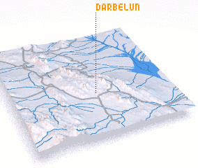 Places with similar names to Darb-e Lūn, Iran ::
// Droblin (PL)
// Droblin (PL)
// Drebulynė (LT)
// Torrebeleña (ES)
// Droblino (RU)
// Dera Bailān (PK)
// Dera Balān (PK)
// Torbellan (VE)
// Drobil'nyy (RU)
// Trebelno (SI)
Disclaimer :: Information on this page comes without warranty of any kind |
||
|
Where is Darb-e Lūn? Elevation and coordinates ::
Latitude (lat): 32°28'0"N Longitude (lon): 60°33'0"E
Elevation (approx.): 1493m (map arrows pan, magnifying glasses zoom) |
||
|
Visiting Darb-e Lūn? Hotel/Accommodation ::
Book a hotel in Darb-e Lūn Travel Guide ::
Buy a travel guide for Iran rental cars ::
car rental offers GPS waypoint ::
download a GPX waypoint (PoI) of Darb-e Lūn for your GPS receiver
|
||