|
search place name
|
||
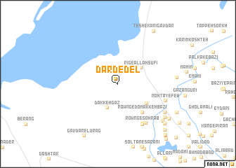
Dard-e-Del (Sīstān va Balūchestān, Iran)Dard-e-Del is a town in the Sīstān va Balūchestān region of Iran. An overview map of the region around Dard-e-Del is displayed below.
regional and 3d topo map of Dard-e-Del, Iran ::
Dard-e-Del airports ::
The nearest airport is ZAH - Zahedan Intl, located 192.7 km south of Dard-e-Del.
Nearby towns ::
Dakkeh Gaz (4.1km south) //
Rīg-e Allāhşūfī (4.0km north east) //
Rowng-e Domakkeh-ye 'eydarī (5.1km south east) //
Rowng-e Domakkeh Bazī (5.6km south east) //
Rowng-e Sohrāb (7.1km south east) //
'ājjī ‘Alī (7.2km south east) //
Naşrābād (7.3km south east) //
Noh Ţāyefeh (7.0km south east) //
Posht-e Adīmī (7.9km south east) //
Mūlī Adīmī (8.4km south east) //
Manşūrī (8.6km south east) //
Posht-e Sar-e Manşūrī (9.1km south east) //
Adīmī (8.9km south east) //
Gāvdār-e Lūrag (9.5km south west) //
Teshekānī Gavdār (9.7km north east) //
Kadkhodā Faqīr (9.7km south east) //
Deh-e‘Īsá Pā'īn (10.4km south east) //
Dasīr-e Pā'īn (10.5km south east) //
Deh-e ‘Īsá Bālā (11.0km south east) //
[all distances 'as the bird flies' and approximate]  Places with similar names to Dard-e-Del, Iran ::
// Troutdale (US)
// Troutdale (US)
// Troutdale (US)
// Trout Dale (US)
// Douar Tadla (MA)
// Douar Tadla (MA)
Disclaimer :: Information on this page comes without warranty of any kind |
||
|
Where is Dard-e-Del? Elevation and coordinates ::
Latitude (lat): 31°10'28"N Longitude (lon): 61°19'54"E
Elevation (approx.): 478m (map arrows pan, magnifying glasses zoom) |
||
|
Visiting Dard-e-Del? Hotel/Accommodation ::
Book a hotel in Dard-e-Del Travel Guide ::
Buy a travel guide for Iran rental cars ::
car rental offers GPS waypoint ::
download a GPX waypoint (PoI) of Dard-e-Del for your GPS receiver
|
||