|
search place name
|
||
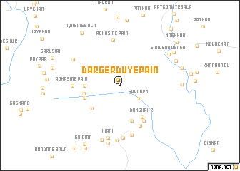
Dar Gerdū-ye Pā'īn (Hormozgān, Iran)Dar Gerdū-ye Pā'īn is a town in the Hormozgān region of Iran. An overview map of the region around Dar Gerdū-ye Pā'īn is displayed below.
regional and 3d topo map of Dar Gerdū-ye Pā'īn, Iran ::
Dar Gerdū-ye Pā'īn airports ::
The nearest airport is BND - Bandar Abbass Intl, located 46.5 km south of Dar Gerdū-ye Pā'īn.
Other airports nearby include KHS - Khasab (163.4 km south), BDH - Bandar Lengeh (202.2 km south west), Nearby towns ::
Sargarm (3.4km south east) //
Dar Gerdū-ye Bālā (4.9km west) //
Pīr Gheyb (5.3km south west) //
Dar Khīzū (5.2km west) //
Mezrākūh (5.8km south) //
Āb Qalamū (5.3km west) //
Domshahr (5.9km south east) //
Kehūrā Qorīsh (6.5km south east) //
Khowrgū (6.9km south east) //
Āghāsīn-e Pā'īn (7.2km north) //
Āghāsīn-e Pā'īn (6.6km west) //
Ebrāhīmī (7.9km south) //
Dar Jatān (8.3km south) //
Dar Beh (7.6km north west) //
Mīānī (8.4km south) //
Shahrū (8.7km south) //
Shahroo (8.7km south) //
Dāvūdī (8.9km south) //
Sang-e Dar Bāgh (8.3km north east) //
Parjangāh (8.6km north east) //
Godār-e Kalūt (9.1km north east) //
Āqāsīn-e Bālā (9.7km north west) //
Māshkār (10.3km north east) //
[all distances 'as the bird flies' and approximate] 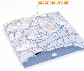 Places with similar names to Dar Gerdū-ye Pā'īn, Iran :: Disclaimer :: Information on this page comes without warranty of any kind |
||
|
Where is Dar Gerdū-ye Pā'īn? Elevation and coordinates ::
Latitude (lat): 27°38'0"N Longitude (lon): 56°27'0"E
Elevation (approx.): 359m (map arrows pan, magnifying glasses zoom) |
||
|
Visiting Dar Gerdū-ye Pā'īn? Hotel/Accommodation ::
Book a hotel in Dar Gerdū-ye Pā'īn Travel Guide ::
Buy a travel guide for Iran rental cars ::
car rental offers GPS waypoint ::
download a GPX waypoint (PoI) of Dar Gerdū-ye Pā'īn for your GPS receiver
|
||