|
search place name
|
||
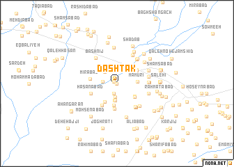
Dashtak (Khorāsān, Iran)Dashtak is a town in the Khorāsān region of Iran. An overview map of the region around Dashtak is displayed below.
regional and 3d topo map of Dashtak, Iran ::
Dashtak airports ::
The nearest airport is ASB - Ashkhabad Ashgabat, located 199.0 km north of Dashtak.
Nearby towns ::
Kamālābād (0.0km west) //
Deh Sang (0.5km north west) //
Raḩīmābād (1.7km south) //
Raḩīmābād (2.2km south) //
Rangān (1.9km west) //
Moḩammadābād (2.4km north east) //
Rostamābād (2.5km north west) //
Qaţnābād (2.7km north west) //
Shāhābād (2.8km south) //
Deh-e Ḩabbeh (2.8km south) //
Manz̧ar (2.6km east) //
Ma‘mūrī (2.6km east) //
Ābjeqān (3.1km south east) //
Shāhābād (3.5km south) //
Golshan (3.3km south west) //
Moz̧affarābād (3.1km south east) //
Seyfābād (3.3km north east) //
Neqāb (3.3km north east) //
Deh-e Lārī (4.1km south) //
Faraḩābād (4.0km south west) //
Mīrābād (3.5km west) //
Ḩasanābād (3.8km south west) //
Moḩīţābād (4.4km south east) //
Ḩakīmābād (4.5km south east) //
Ārezūmandeh (4.6km south east) //
Ḩeşār-e Khūnī (4.7km north east) //
Feyẕābād (4.1km east) //
‘Eshqābād (4.7km north east) //
Feyẕābād (4.1km east) //
[all distances 'as the bird flies' and approximate]  Places with similar names to Dashtak, Iran ::
Disclaimer :: Information on this page comes without warranty of any kind |
||
|
Where is Dashtak? Elevation and coordinates ::
Latitude (lat): 36°12'53"N Longitude (lon): 58°42'15"E
Elevation (approx.): 1151m (map arrows pan, magnifying glasses zoom) |
||
|
Visiting Dashtak? Hotel/Accommodation ::
Book a hotel in Dashtak Travel Guide ::
Buy a travel guide for Iran rental cars ::
car rental offers GPS waypoint ::
download a GPX waypoint (PoI) of Dashtak for your GPS receiver
|
||