|
search place name
|
||
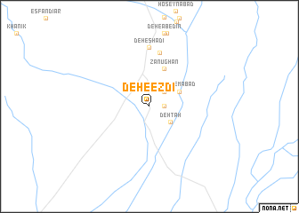
Deh-e Ezdī (Khorāsān, Iran)Deh-e Ezdī is a town in the Khorāsān region of Iran. An overview map of the region around Deh-e Ezdī is displayed below.
regional and 3d topo map of Deh-e Ezdī, Iran ::
Deh-e Ezdī airports ::
The nearest airport is XBJ - Birjand, located 149.7 km east of Deh-e Ezdī.
Nearby towns ::
‘Arabābād (1.6km east) //
Dowlatābād (2.4km north east) //
Deh Tah (2.9km south east) //
Qāsemābād (3.6km north east) //
Zanūghān (5.0km north) //
Deh Now (6.8km north) //
Deh-e Shādī (7.4km north) //
[all distances 'as the bird flies' and approximate]  Places with similar names to Deh-e Ezdī, Iran ::
// Tahaouast (MA)
// Tahoe City (US)
// Ţoheşti (RO)
// Deh-e Āzād (IR)
// Dhista (BD)
// Deh-e Sa‘īd (IR)
// Tauhá see Tauá (BR)
// Deh-e Seyyed (IR)
Disclaimer :: Information on this page comes without warranty of any kind |
||
|
Where is Deh-e Ezdī? Elevation and coordinates ::
Latitude (lat): 32°57'0"N Longitude (lon): 57°40'0"E
Elevation (approx.): 909m (map arrows pan, magnifying glasses zoom) |
||
|
Visiting Deh-e Ezdī? Hotel/Accommodation ::
Book a hotel in Deh-e Ezdī Travel Guide ::
Buy a travel guide for Iran rental cars ::
car rental offers GPS waypoint ::
download a GPX waypoint (PoI) of Deh-e Ezdī for your GPS receiver
|
||