|
search place name
|
||
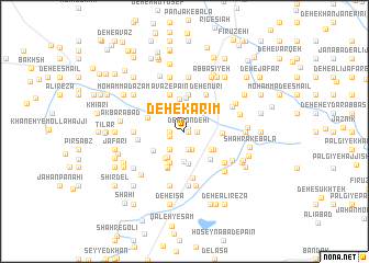
Deh-e Karīm (Sīstān va Balūchestān, Iran)Deh-e Karīm is a town in the Sīstān va Balūchestān region of Iran. An overview map of the region around Deh-e Karīm is displayed below.
regional and 3d topo map of Deh-e Karīm, Iran ::
Deh-e Karīm airports ::
The nearest airport is ZAH - Zahedan Intl, located 164.0 km south of Deh-e Karīm.
Nearby towns ::
Deh-e Āqā'ī (0.3km east) //
Panjak-e Pā'īn (0.3km east) //
Deh Bondehī (0.4km north east) //
Deh-e Karbalā'ī ‘Alī (1.1km east) //
Deh-e Reẕā (1.3km west) //
Qal‘eh-ye Ḩasan (1.4km west) //
Moḩammad ‘Alī (1.9km south) //
Kūsheh-ye Bālā (1.9km south) //
Maḩmūdābād (1.9km south) //
Keykhā (1.9km south) //
Deh Now (2.3km south west) //
Chong-e Morghān (2.5km north) //
Kūsheh-ye Pā'īn (3.1km south) //
‘Eshqābād (3.0km south west) //
Pol-e Asbī-ye Allāhābād (3.3km south) //
Gazmūn-e Kūsheh (3.0km south east) //
Khāneh-ye Golmoḩammad (3.3km north) //
Deh-e ‘Alī (3.2km south west) //
‘Īsáābād (3.5km north) //
Gazmū (3.1km south east) //
Ḩoseyn ‘Alīakbar (3.5km south) //
Deh-e Khānī (3.5km south) //
Ebrāhīmābād (3.7km north) //
Kūsheh-ye Mīān (3.4km south west) //
Moḩammadābād-e Shīb Āb (3.3km east) //
Malekābād (3.7km south east) //
Cheleng (3.5km north west) //
Kūchek Zā'ī (3.9km south west) //
‘Avaẕ-e Pā'īn (3.9km north) //
[all distances 'as the bird flies' and approximate]  Places with similar names to Deh-e Karīm, Iran ::
Disclaimer :: Information on this page comes without warranty of any kind |
||
|
Where is Deh-e Karīm? Elevation and coordinates ::
Latitude (lat): 30°53'0"N Longitude (lon): 61°25'49"E
Elevation (approx.): 480m (map arrows pan, magnifying glasses zoom) |
||
|
Visiting Deh-e Karīm? Hotel/Accommodation ::
Book a hotel in Deh-e Karīm Travel Guide ::
Buy a travel guide for Iran rental cars ::
car rental offers GPS waypoint ::
download a GPX waypoint (PoI) of Deh-e Karīm for your GPS receiver
|
||