|
search place name
|
||
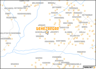
Deh-e Zargar (Khorāsān, Iran)Deh-e Zargar is a town in the Khorāsān region of Iran. An overview map of the region around Deh-e Zargar is displayed below.
regional and 3d topo map of Deh-e Zargar, Iran ::
Deh-e Zargar airports ::
The nearest airport is ASB - Ashkhabad Ashgabat, located 205.7 km north of Deh-e Zargar.
Nearby towns ::
Shādāb Shūr (1.9km south west) //
Moḩsenābād (2.1km north) //
Ḩoseunābād (2.2km north) //
Joghrātī (2.2km east) //
Deh-e Ḩājjī (2.4km west) //
Ḩeshmatīyeh (2.7km south east) //
Sa‘dābād (2.9km south west) //
Raḩīmābād (3.5km south) //
Jomhūrī (3.4km north west) //
Āhangarān (3.5km north west) //
Deh Mūrī (4.1km south east) //
Faraḩābād (4.4km north east) //
Golshan (5.0km north east) //
Deh-e Lārī (4.9km north east) //
Ḩasanābād (5.7km north) //
Shāhābād (5.3km north east) //
Şowme‘eh (5.4km south east) //
Shafī‘ābād (5.3km south east) //
Deh-e Ḩabbeh (5.9km north east) //
Shāhābād (5.9km north east) //
Shamsīyeh (5.5km east) //
Alījeh Gerd (5.5km east) //
Raḩīmābād (6.4km north east) //
Moḩammadābād (6.2km south east) //
Raḩīmābād (6.8km north east) //
Shāmekh (6.2km east) //
Rangān (7.9km north) //
Mīrābād (8.1km north) //
‘Alīābād (6.6km east) //
[all distances 'as the bird flies' and approximate]  Places with similar names to Deh-e Zargar, Iran :: Disclaimer :: Information on this page comes without warranty of any kind |
||
|
Where is Deh-e Zargar? Elevation and coordinates ::
Latitude (lat): 36°8'55"N Longitude (lon): 58°39'35"E
Elevation (approx.): 1112m (map arrows pan, magnifying glasses zoom) |
||
|
Visiting Deh-e Zargar? Hotel/Accommodation ::
Book a hotel in Deh-e Zargar Travel Guide ::
Buy a travel guide for Iran rental cars ::
car rental offers GPS waypoint ::
download a GPX waypoint (PoI) of Deh-e Zargar for your GPS receiver
|
||