|
search place name
|
||
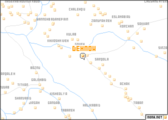
Deh Now (Eşfahān, Iran)Deh Now is a town in the Eşfahān region of Iran. An overview map of the region around Deh Now is displayed below.
regional and 3d topo map of Deh Now, Iran ::
Deh Now airports ::
The nearest airport is QMJ - Masjed Soleiman Shahid Asyaee, located 113.4 km south west of Deh Now.
Other airports nearby include AWZ - Ahwaz (200.7 km south west), Nearby towns ::
Dastgerd (1.3km north east) //
Bahrāmābād (1.4km south east) //
Chālcherāneh (2.5km north) //
Goveh (2.5km north) //
Chālvāreh (2.8km west) //
Ḩabībak (3.4km south east) //
Sar Qolā‘ (3.7km east) //
Gharāneh (4.7km north) //
Kūlāb (5.1km north west) //
Darreh-ye Chīleh (5.0km south east) //
Kū'īān (5.0km north west) //
Khvosh Mīveh (5.7km north west) //
‘Anāyesht (6.0km south east) //
Bābā Khosrow (7.2km south east) //
Ţorzeh (7.3km south east) //
Kūlāb (8.1km north) //
Zard Fahreh (8.4km north east) //
Bīsheh Khazān (8.6km north west) //
Darreh Bādām-e Bālā (9.3km north west) //
Kīsh-e ‘Olyā (9.8km south west) //
Tazareh (9.5km north west) //
Darreh Bādām-e Pā'īn (9.9km north west) //
Darreh Bādām-e Mīāneh (10.1km north west) //
Abowl (10.6km north east) //
Eslāmābād (11.1km north east) //
[all distances 'as the bird flies' and approximate] 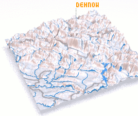 Places with similar names to Deh Now, Iran ::
Disclaimer :: Information on this page comes without warranty of any kind |
||
|
Where is Deh Now? Elevation and coordinates ::
Latitude (lat): 32°56'33"N Longitude (lon): 49°44'44"E
Elevation (approx.): 2105m (map arrows pan, magnifying glasses zoom) |
||
|
Visiting Deh Now? Hotel/Accommodation ::
Book a hotel in Deh Now Travel Guide ::
Buy a travel guide for Iran rental cars ::
car rental offers GPS waypoint ::
download a GPX waypoint (PoI) of Deh Now for your GPS receiver
|
||