|
search place name
|
||
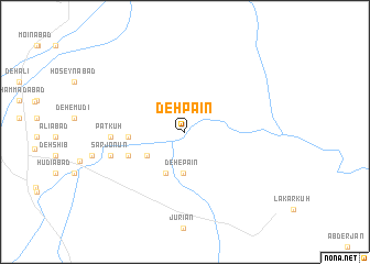
Deh Pāʼīn (Kermān, Iran)Deh Pāʼīn is a town in the Kermān region of Iran. An overview map of the region around Deh Pāʼīn is displayed below.
regional and 3d topo map of Deh Pāʼīn, Iran ::
Deh Pāʼīn airports ::
The nearest airport is KER - Kerman, located 112.3 km south of Deh Pāʼīn.
Nearby towns ::
Deh-e Pāʼīn (4.2km south) //
Deh Mīān (4.0km south west) //
Gochārak (4.5km south) //
Deh-e Mīr Şāleḩ (4.9km west) //
Sar Gazān (5.4km south west) //
Patkūh (6.5km west) //
Deh-e Moḩammad Beyk (6.5km west) //
Sarjonūn (6.9km west) //
Barāftāb (6.9km west) //
Deh-e Manbek (6.9km west) //
[all distances 'as the bird flies' and approximate] 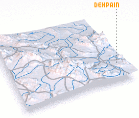 Places with similar names to Deh Pāʼīn, Iran ::
Disclaimer :: Information on this page comes without warranty of any kind |
||
|
Where is Deh Pāʼīn? Elevation and coordinates ::
Latitude (lat): 31°17'16"N Longitude (lon): 56°57'5"E
Elevation (approx.): 1081m (map arrows pan, magnifying glasses zoom) |
||
|
Visiting Deh Pāʼīn? Hotel/Accommodation ::
Book a hotel in Deh Pāʼīn Travel Guide ::
Buy a travel guide for Iran rental cars ::
car rental offers GPS waypoint ::
download a GPX waypoint (PoI) of Deh Pāʼīn for your GPS receiver
|
||