|
search place name
|
||
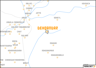
Dehqāndar (Sīstān va Balūchestān, Iran)Dehqāndar is a town in the Sīstān va Balūchestān region of Iran. An overview map of the region around Dehqāndar is displayed below.
regional and 3d topo map of Dehqāndar, Iran ::
Dehqāndar airports ::
The nearest airport is GWD - Gwadar, located 97.7 km south east of Dehqāndar.
Other airports nearby include ZBR - Chah Bahar (113.4 km west), TRB - Turbo Turbat Intl (159.1 km east), PSI - Pasni (191.8 km east), Nearby towns ::
Rohgām (4.9km south east) //
Soheyl (6.5km north east) //
Rohgām-e Pā'īn (7.4km south) //
Dalvash Bāzār (7.6km north west) //
Jūyīg (8.1km north west) //
Bāhū Kalāt (8.6km north west) //
Morūkī (10.0km north west) //
[all distances 'as the bird flies' and approximate]  Places with similar names to Dehqāndar, Iran ::
// Dikendere (TR)
// Doğandere (TR)
// Doqondar (IR)
// Doukoundri (BJ)
// Dokondère (CF)
// Diakoundaré (SN)
// Tekindere (TR)
// Taʼ Ċantar (MT)
// Dukkān aḑ Ḑahr (LB)
// Diogountourou (MR)
Disclaimer :: Information on this page comes without warranty of any kind |
||
|
Where is Dehqāndar? Elevation and coordinates ::
Latitude (lat): 25°40'0"N Longitude (lon): 61°29'0"E
Elevation (approx.): 34m (map arrows pan, magnifying glasses zoom) |
||
|
Visiting Dehqāndar? Hotel/Accommodation ::
Book a hotel in Dehqāndar Travel Guide ::
Buy a travel guide for Iran rental cars ::
car rental offers GPS waypoint ::
download a GPX waypoint (PoI) of Dehqāndar for your GPS receiver
|
||