|
search place name
|
||
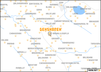
Deh Shāreh (Khūzestān, Iran)Deh Shāreh is a town in the Khūzestān region of Iran. An overview map of the region around Deh Shāreh is displayed below.
regional and 3d topo map of Deh Shāreh, Iran ::
Deh Shāreh airports ::
The nearest airport is QMJ - Masjed Soleiman Shahid Asyaee, located 61.1 km north west of Deh Shāreh.
Other airports nearby include AWZ - Ahwaz (110.8 km south west), MRX - Bandar Mahshahr Mahshahr (145.8 km south west), ABD - Abadan (215.1 km south west), Nearby towns ::
Chashmeh Meydānak (0.0km north) //
Bībī Gol Mordeh (0.6km north west) //
Bārāngerd (2.5km south) //
Bībī Gol Mordeh-ye Soflá (2.4km north west) //
Gāvdārī (2.4km south east) //
Chāshnīdān (3.7km south) //
Halāyjān (3.7km north) //
Nāshalīl-e Soflá (3.2km east) //
Nāshelīl (3.5km east) //
Sar Kān-e Bālā (3.7km west) //
Parreh Sīlā (4.5km south) //
Chahār Tang Soflá (4.4km north east) //
Chahār Tang-e Vosţá (4.9km north east) //
Kān Gonjeshkī (5.4km south) //
Boneh-ye Mollā Rajab (5.6km south) //
Cheshmeh Gorgī (5.7km south) //
Boneh-ye Karbalā'ī Ḩājj (5.1km west) //
Shahrak-e Sharī‘atī (5.8km north) //
Rameh Char (5.1km west) //
Par Sūrākh (5.8km south) //
Borj-e Farajollāh Khān (5.8km south) //
Fereydūnī (6.1km south west) //
Chahār Tang-e ‘Olyā (6.2km north east) //
Shahrak-e Ţāleqānī (6.4km north west) //
Jūghband (6.0km south west) //
Boneh-ye Ḩasan Khān (6.4km south west) //
Jūghanjīr (6.4km south west) //
Sarākān ‘Olyā (6.9km north west) //
Halāyjān (7.4km north) //
[all distances 'as the bird flies' and approximate]  Places with similar names to Deh Shāreh, Iran ::
Disclaimer :: Information on this page comes without warranty of any kind |
||
|
Where is Deh Shāreh? Elevation and coordinates ::
Latitude (lat): 31°44'0"N Longitude (lon): 49°50'0"E
Elevation (approx.): 994m (map arrows pan, magnifying glasses zoom) |
||
|
Visiting Deh Shāreh? Hotel/Accommodation ::
Book a hotel in Deh Shāreh Travel Guide ::
Buy a travel guide for Iran rental cars ::
car rental offers GPS waypoint ::
download a GPX waypoint (PoI) of Deh Shāreh for your GPS receiver
|
||