|
search place name
|
||
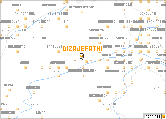
Dīzaj-e Fatḩī (Ostān-e Āz̄arbāyjān-e Gharbī, Iran)Dīzaj-e Fatḩī is a town in the Ostān-e Āz̄arbāyjān-e Gharbī region of Iran. An overview map of the region around Dīzaj-e Fatḩī is displayed below.
regional and 3d topo map of Dīzaj-e Fatḩī, Iran ::
Dīzaj-e Fatḩī airports ::
The nearest airport is TBZ - Tabriz Intl, located 131.3 km north east of Dīzaj-e Fatḩī.
Other airports nearby include VAN - Van (193.1 km north west), Nearby towns ::
Khorramābād (0.9km south east) //
Sha‘bān Kandī (1.5km east) //
Bārāndūz (1.5km east) //
Angamān (1.5km west) //
Ḩasū Kandī (1.9km south) //
Varmazyār (1.9km south) //
Ḩeşār-e Āqbolāgh (3.7km south) //
Tāzeh Kand-e Jamālkhān (2.9km east) //
Āqbolāgh (4.0km south) //
Sheykhlar-e Mazārī (4.0km north) //
Dīzaj-e Raḩīmpūr (3.5km north east) //
Jījak (3.5km south west) //
Dīdān-e ‘Olyā (4.7km north east) //
Nīvlū (4.4km east) //
Khaţāylū (5.8km north) //
Ja‘farīān (4.8km south west) //
Sā‘atlū-ye Kūh (4.8km north west) //
Havandak (4.8km north west) //
Mobārakābād (4.8km south east) //
Sīr Dāghī (5.8km south west) //
Narleh (5.8km south west) //
Sārī Beyglū (6.3km north east) //
Kārvānsarā (5.9km east) //
Kūrānī (6.2km east) //
‘Alīābād (6.2km east) //
Gazanehkesh (6.2km west) //
Maḩmūdābād (7.0km south east) //
Dīdān-e Soflá (7.0km north east) //
Sīdak (7.0km south west) //
[all distances 'as the bird flies' and approximate] 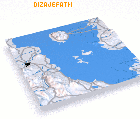 Places with similar names to Dīzaj-e Fatḩī, Iran :: Disclaimer :: Information on this page comes without warranty of any kind |
||
|
Where is Dīzaj-e Fatḩī? Elevation and coordinates ::
Latitude (lat): 37°24'0"N Longitude (lon): 45°4'0"E
Elevation (approx.): 1352m (map arrows pan, magnifying glasses zoom) |
||
|
Visiting Dīzaj-e Fatḩī? Hotel/Accommodation ::
Book a hotel in Dīzaj-e Fatḩī Travel Guide ::
Buy a travel guide for Iran rental cars ::
car rental offers GPS waypoint ::
download a GPX waypoint (PoI) of Dīzaj-e Fatḩī for your GPS receiver
|
||