|
search place name
|
||
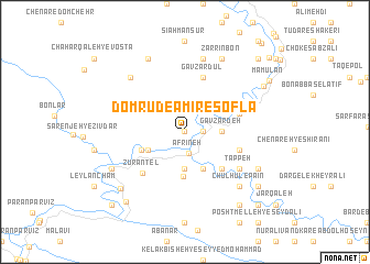
Domrūd-e Amīr-e Soflá (Lorestān, Iran)Domrūd-e Amīr-e Soflá is a town in the Lorestān region of Iran. An overview map of the region around Domrūd-e Amīr-e Soflá is displayed below.
regional and 3d topo map of Domrūd-e Amīr-e Soflá, Iran ::
Domrūd-e Amīr-e Soflá airports ::
The nearest airport is KSH - Bakhtaran Shahid Ashrafi Esfahani, located 130.8 km north west of Domrūd-e Amīr-e Soflá.
Other airports nearby include QMJ - Masjed Soleiman Shahid Asyaee (196.8 km south east), SDG - Sanandaj (226.9 km north), AWZ - Ahwaz (236.3 km south), Nearby towns ::
Domrūd-e Amīr-e Vosţá (0.0km north) //
Domrūd-e Amīr-e ‘Olyā (1.5km east) //
Afrīneh (2.2km south) //
Dar Āghol Begīr-e Laţīf (3.7km south) //
Gāv Zardeh (3.1km east) //
Bargalān Sūkhteh (3.6km south west) //
Tolombeh Khāneh-ye Āfarīneh (3.6km south west) //
Ţāq Rezāleh-ye Moḩammad Āqā (4.0km south east) //
Afrīneh-ye Pāʼīn (4.5km south) //
Kalek-e Zūrāntel (4.1km south west) //
Kolengkū (4.8km south east) //
Cham Bārīkeh (4.8km south east) //
Sartakht-e Qadam Kheyr (4.8km south east) //
Meleh-ye Posht-e Sar Takht (4.8km south east) //
Kelak Mīān-e ‘Alī Āqā Naz̧arī (5.0km east) //
Gāv Zardūl (5.8km north) //
Cham-e Shahrān (5.0km east) //
Cham Kabūd (5.0km east) //
Zūrāntel (5.5km south west) //
Darvāzeh-ye Sartakht (5.9km south east) //
Tappeh (5.9km south east) //
Hapelāneh (7.6km north) //
Chahār Qal‘eh-ye Bārānī (7.2km north west) //
Chūlhūl-e Pāʼīn (7.2km south east) //
Barāftāb (7.2km south west) //
Kalāt (7.2km south west) //
Ţīār-e Amīrān (8.0km north west) //
Darreh Bāgh-e Moḩammad Ḩoseyn (7.2km south east) //
Zarrīn Bon (8.0km north east) //
[all distances 'as the bird flies' and approximate] 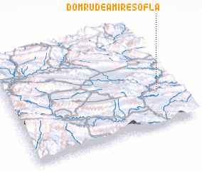 Places with similar names to Domrūd-e Amīr-e Soflá, Iran :: Disclaimer :: Information on this page comes without warranty of any kind |
||
|
Where is Domrūd-e Amīr-e Soflá? Elevation and coordinates ::
Latitude (lat): 33°20'0"N Longitude (lon): 47°53'0"E
Elevation (approx.): 825m (map arrows pan, magnifying glasses zoom) |
||
|
Visiting Domrūd-e Amīr-e Soflá? Hotel/Accommodation ::
Book a hotel in Domrūd-e Amīr-e Soflá Travel Guide ::
Buy a travel guide for Iran rental cars ::
car rental offers GPS waypoint ::
download a GPX waypoint (PoI) of Domrūd-e Amīr-e Soflá for your GPS receiver
|
||