|
search place name
|
||
Dowlatābād (Eşfahān, Iran)Dowlatābād is a town in the Eşfahān region of Iran. An overview map of the region around Dowlatābād is displayed below.
regional and 3d topo map of Dowlatābād, Iran ::

Nearby towns ::
Mūsáābād (1.8km west) //
‘Alīābād-e Gachchī (2.4km north east) //
Gerd Mehdīābād (2.8km north west) //
Maḩmūdābād (4.7km west) //
Qaşr-e Cham (6.1km south east) //
Gerd-e Maḩmūdābād (6.5km north west) //
Darreh Tang Āb (7.5km south west) //
Chāh-e Karīm Sabzevārī (7.6km north east) //
Moḩammadīyeh (7.3km east) //
Āsīāb-e Khān (10.6km north east) //
Kīānābād (10.8km north west) //
[all distances 'as the bird flies' and approximate] 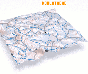 Places with similar names to Dowlatābād, Iran ::
// Dowlatābād (IR)
// Dowlatābād (IR)
// Dowlatābād (IR)
// Dowlatābād (IR)
// Dowlatābād (IR)
// Dowlatābād (IR)
// Dowlatābād (IR)
// Dowlatābād (IR)
// Dowlatābād (IR)
// Dowlatābād (IR)
Disclaimer :: Information on this page comes without warranty of any kind |
||
|
Where is Dowlatābād? Elevation and coordinates ::
Latitude (lat): 31°55'26"N Longitude (lon): 51°45'44"E
Elevation (approx.): 1939m (map arrows pan, magnifying glasses zoom) |
||
|
Visiting Dowlatābād? Hotel/Accommodation ::
Book a hotel in Dowlatābād Travel Guide ::
Buy a travel guide for Iran rental cars ::
car rental offers GPS waypoint ::
download a GPX waypoint (PoI) of Dowlatābād for your GPS receiver
|
||