|
search place name
|
||
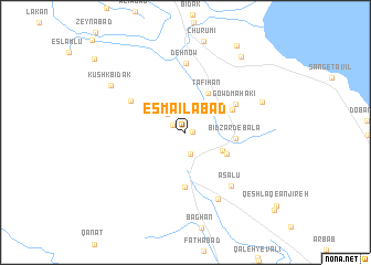
Esmā‘īlābād (Fārs, Iran)Esmā‘īlābād is a town in the Fārs region of Iran. An overview map of the region around Esmā‘īlābād is displayed below.
regional and 3d topo map of Esmā‘īlābād, Iran ::
Esmā‘īlābād airports ::
The nearest airport is SYZ - Shiraz Shahid Dastghaib Intl, located 17.8 km north of Esmā‘īlābād.
Other airports nearby include BUZ - Bushehr (181.6 km west), Nearby towns ::
Kūshk-e Khalīl (0.6km east) //
Dowlatābād (1.3km north west) //
Maḩmūdābād (2.3km south) //
Dehak (2.5km north west) //
Bābā Ḩājjī (3.7km south east) //
Tafīhān (4.4km north east) //
Tang-e Naz̧arī (4.2km south east) //
Bīd Zard-e Bālā (4.4km east) //
Qal‘eh Īzadī (4.7km north east) //
Gardaneh-ye Bābā Ḩājjī (5.6km south) //
Gowd Mahakī (5.2km north east) //
Z̧afarābād (5.8km north west) //
Deh Now (7.0km north) //
‘Asalū (6.7km south east) //
Kūreh (7.3km south east) //
Bīd Zard-e Pā'īn (7.5km north east) //
Kūshk Bīdak (8.1km north west) //
Barm Shūr-e Bālā (9.1km north east) //
Barm Shūr-e Pā'īn (9.9km north east) //
[all distances 'as the bird flies' and approximate] 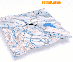 Places with similar names to Esmā‘īlābād, Iran ::
// Esmā‘īlābād (IR)
// Esmā‘īlābād (IR)
// Esmā‘īlābād (IR)
// Esmā‘īlābād (IR)
// Esmā‘īlābād (IR)
// Esmā‘īlābād (IR)
// Esmā‘īlābād (IR)
// Esmā‘īlābād (IR)
// Eşmā'īlābād (IR)
// Esma‘īlābād (IR)
Disclaimer :: Information on this page comes without warranty of any kind |
||
|
Where is Esmā‘īlābād? Elevation and coordinates ::
Latitude (lat): 29°23'0"N Longitude (lon): 52°38'0"E
Elevation (approx.): 1483m (map arrows pan, magnifying glasses zoom) |
||
|
Visiting Esmā‘īlābād? Hotel/Accommodation ::
Book a hotel in Esmā‘īlābād Travel Guide ::
Buy a travel guide for Iran rental cars ::
car rental offers GPS waypoint ::
download a GPX waypoint (PoI) of Esmā‘īlābād for your GPS receiver
|
||