|
search place name
|
||
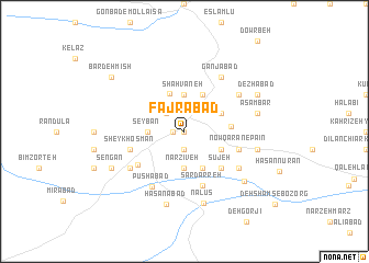
Fajrābād (Ostān-e Āz̄arbāyjān-e Gharbī, Iran)Fajrābād is a town in the Ostān-e Āz̄arbāyjān-e Gharbī region of Iran. An overview map of the region around Fajrābād is displayed below.
regional and 3d topo map of Fajrābād, Iran ::
Fajrābād airports ::
The nearest airport is TBZ - Tabriz Intl, located 154.7 km north east of Fajrābād.
Other airports nearby include VAN - Van (223.5 km north west), SDG - Sanandaj (261.9 km south east), Nearby towns ::
Nowqarān-e Bālā (0.0km north) //
Oshnavīyeh (0.9km west) //
Kūroshābād (1.9km south) //
Qāzānābād (1.9km south) //
Pūleh (2.4km north west) //
Nalīvān (2.4km north west) //
Narzīveh (3.7km south) //
Seybān (3.0km west) //
Shāhvāneh (3.7km north) //
Parvāneh (4.0km north) //
Khāledābād (4.0km south) //
Gerd-e Kāshān (4.0km north) //
Jebrā'īlābād (3.5km south east) //
Eslāmābād (3.5km south east) //
Sūrīyeh (3.5km north east) //
‘Alīābād (3.9km east) //
Sūjeh (4.7km south east) //
Denkheh (4.7km south east) //
Senowkesh (5.1km south west) //
Sheykh‘Os̄mān (4.8km south west) //
Sar Darreh (5.8km south) //
Nowqarān-e Pā'īn (4.8km south east) //
Pūshābād (6.3km south west) //
Amīrābād (5.8km south west) //
Peyrūtābād (5.8km south east) //
Bīzhanābād (5.8km north east) //
Ganjābād (6.3km north east) //
Nālūs (7.5km south) //
Ḩasanābād (7.6km south) //
[all distances 'as the bird flies' and approximate] 
Disclaimer :: Information on this page comes without warranty of any kind |
||
|
Where is Fajrābād? Elevation and coordinates ::
Latitude (lat): 37°3'0"N Longitude (lon): 45°8'0"E
Elevation (approx.): 1408m (map arrows pan, magnifying glasses zoom) |
||
|
Visiting Fajrābād? Hotel/Accommodation ::
Book a hotel in Fajrābād Travel Guide ::
Buy a travel guide for Iran rental cars ::
car rental offers GPS waypoint ::
download a GPX waypoint (PoI) of Fajrābād for your GPS receiver
|
||