|
search place name
|
||
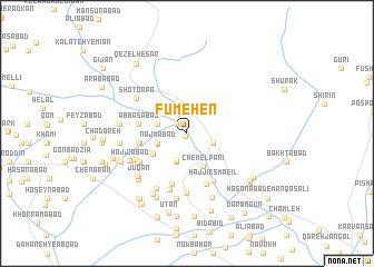
Fūmehen (Khorāsān, Iran)Fūmehen is a town in the Khorāsān region of Iran. An overview map of the region around Fūmehen is displayed below.
regional and 3d topo map of Fūmehen, Iran ::
Fūmehen airports ::
The nearest airport is ASB - Ashkhabad Ashgabat, located 162.2 km north west of Fūmehen.
Nearby towns ::
Kalāteh-ye Shekar (0.3km south) //
Now Mehan (1.3km north west) //
Kalāteh-ye Rezā (2.3km south east) //
‘Abbās Khān-e Qareh Gol (2.9km south) //
‘Abbās Khān-e Qareh Gol (3.0km south) //
Kalāteh-ye Khānū (2.6km south west) //
Nahrābād (2.6km west) //
Golūm (2.6km west) //
Kalāteh-ye Khānū (2.6km south west) //
Mo'menābād (2.6km west) //
Najmābād (2.6km west) //
Chehel Parī (3.5km south) //
Ḩīţeh Ţalā (3.4km south west) //
Yūsefābād (3.4km south west) //
Moḩammad Ḩasan Beyk (4.0km west) //
‘Abbāsābād (4.0km west) //
Moḩammad Ḩasan Beyk (4.0km west) //
Mehdīābād (5.2km south) //
Mehdī Solţān (5.3km south) //
Ḩājjī Esmāe‘īl (5.1km south east) //
Ḩājjī Esmāe‘īl (5.3km south) //
Ḩājjīābād (4.8km south west) //
Keremgān (4.8km south west) //
Qal‘eh Now (4.9km south west) //
Sar Āsīāb (5.8km south) //
Manqeshlī (6.0km south) //
Shotor Pā (5.4km north west) //
Ḩasanābād-e Khān (5.3km south west) //
Ḩājjīābād (5.3km south west) //
[all distances 'as the bird flies' and approximate] 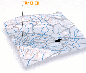 Places with similar names to Fūmehen, Iran ::
// Phumĭ Ahên (KH)
// Vemhån (SE)
Disclaimer :: Information on this page comes without warranty of any kind |
||
|
Where is Fūmehen? Elevation and coordinates ::
Latitude (lat): 36°41'32"N Longitude (lon): 59°12'35"E
Elevation (approx.): 1111m (map arrows pan, magnifying glasses zoom) |
||
|
Visiting Fūmehen? Hotel/Accommodation ::
Book a hotel in Fūmehen Travel Guide ::
Buy a travel guide for Iran rental cars ::
car rental offers GPS waypoint ::
download a GPX waypoint (PoI) of Fūmehen for your GPS receiver
|
||