|
search place name
|
||
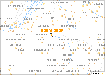
Gand Lāvar (Gīlān, Iran)Gand Lāvar is a town in the Gīlān region of Iran. An overview map of the region around Gand Lāvar is displayed below.
regional and 3d topo map of Gand Lāvar, Iran ::
Gand Lāvar airports ::
The nearest airport is RAS - Rasht, located 40.1 km north of Gand Lāvar.
Other airports nearby include RZR - Ramsar (83.2 km east), THR - Teheran Mehrabad Intl (200.8 km south east), Nearby towns ::
Lapeh Sarā (2.9km north west) //
Halū Dasht (3.4km north east) //
Sīstān (3.7km south) //
Vīlāmā Deh (3.0km west) //
Kelār Deh (3.5km south east) //
Rūdsar (3.5km south west) //
Lābon (3.5km south east) //
Gelehzārū (3.9km north west) //
Shamīndīm (4.6km north) //
Sūsarā (4.9km north) //
Sangeh Sar (4.7km south east) //
Chenār Sarā (5.8km south) //
Bām (5.9km north) //
Mādar Sarā (6.3km north) //
Khomeynī Sarā (5.5km north east) //
Dowlīyeh Sarā (6.3km south west) //
Yektā Sarā (6.2km east) //
Lasāneh (6.2km east) //
Gol Bījār (7.6km north) //
Delamdeh (6.5km west) //
Shīrīn Anāreh (7.9km north west) //
Salāb (7.0km north west) //
Nesā' Kūh (7.1km north west) //
Golestān Sarā (8.2km north) //
Mīrzā Golband (7.7km north west) //
Eshkorāb (8.2km north east) //
Nānpa (7.7km north east) //
Poshteh Sarā (7.7km north west) //
Mūsh Bījār (7.6km north west) //
[all distances 'as the bird flies' and approximate]  Places with similar names to Gand Lāvar, Iran ::
// Qanāt al Gharrah (SY)
Disclaimer :: Information on this page comes without warranty of any kind |
||
|
Where is Gand Lāvar? Elevation and coordinates ::
Latitude (lat): 36°59'0"N Longitude (lon): 49°45'0"E
Elevation (approx.): 439m (map arrows pan, magnifying glasses zoom) |
||
|
Visiting Gand Lāvar? Hotel/Accommodation ::
Book a hotel in Gand Lāvar Travel Guide ::
Buy a travel guide for Iran rental cars ::
car rental offers GPS waypoint ::
download a GPX waypoint (PoI) of Gand Lāvar for your GPS receiver
|
||