|
search place name
|
||
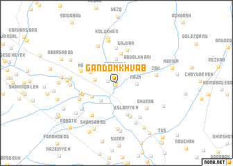
Gandom Khvāb (Khorāsān, Iran)Gandom Khvāb is a town in the Khorāsān region of Iran. An overview map of the region around Gandom Khvāb is displayed below.
regional and 3d topo map of Gandom Khvāb, Iran ::
Gandom Khvāb airports ::
The nearest airport is ASB - Ashkhabad Ashgabat, located 190.4 km north west of Gandom Khvāb.
Nearby towns ::
Aḩmadābād (0.0km north) //
Jaghneh Ḩaẕratī (0.3km south west) //
Yazdān Bolāgh (0.4km south) //
Jeghneh Kharābeh (1.1km west) //
Naşrābād (1.9km north) //
Najm (2.6km east) //
Cheshmeh-e ‘Alīvān (2.8km west) //
Kalāteh-ye Cheshmeh ‘Alīvān (2.9km west) //
Shāh Ţaqá (3.8km north) //
Deheshk (3.5km south west) //
Mehrābād (3.8km north west) //
Sar Āsīāb-e Bālā (3.9km south west) //
‘Abd ol Khānī (4.2km north east) //
Govāreshk (4.8km north) //
Eslāmīyeh (5.3km south) //
Gajvān (5.5km north) //
Deh Now (5.6km north) //
Qāderābād (4.8km south west) //
Shahr-e Ţūs (5.7km south) //
Sahleddīn (4.9km west) //
Dandāneh (5.1km north west) //
Shūrāb (5.6km south east) //
Chahār Borj (6.1km south west) //
Zāk (5.3km east) //
Sar Āsīāb-e Pā'īn (5.5km south west) //
Fakhrābād (6.4km north) //
Ţūs-e Soflá (6.3km south east) //
Shāhrāh (6.2km south west) //
Valīābād (7.0km north) //
[all distances 'as the bird flies' and approximate]  Places with similar names to Gandom Khvāb, Iran :: Disclaimer :: Information on this page comes without warranty of any kind |
||
|
Where is Gandom Khvāb? Elevation and coordinates ::
Latitude (lat): 36°31'59"N Longitude (lon): 59°29'59"E
Elevation (approx.): 1039m (map arrows pan, magnifying glasses zoom) |
||
|
Visiting Gandom Khvāb? Hotel/Accommodation ::
Book a hotel in Gandom Khvāb Travel Guide ::
Buy a travel guide for Iran rental cars ::
car rental offers GPS waypoint ::
download a GPX waypoint (PoI) of Gandom Khvāb for your GPS receiver
|
||