|
search place name
|
||
Ganj‘alīābād (Lorestān, Iran)Ganj‘alīābād is a town in the Lorestān region of Iran. An overview map of the region around Ganj‘alīābād is displayed below.
regional and 3d topo map of Ganj‘alīābād, Iran ::

Ganj‘alīābād airports ::
The nearest airport is KSH - Bakhtaran Shahid Ashrafi Esfahani, located 145.3 km north of Ganj‘alīābād.
Other airports nearby include QMJ - Masjed Soleiman Shahid Asyaee (192.4 km south east), AWZ - Ahwaz (221.2 km south east), Nearby towns ::
Dār Balūţābād (0.0km north) //
Sarāb Ḩammām (1.1km south west) //
Ţaţarābād (1.9km north) //
Raḩīmābād (1.9km north) //
Ţāq-e Seyyed (1.9km north) //
Qapūndar (2.1km north) //
Sarāb-e Jahāngīr (2.6km south east) //
Cham Qal‘eh (3.1km north west) //
Zeydār (3.1km east) //
Do Kūheh-ye Rashnow (3.6km north west) //
Mīrābād (4.1km south east) //
Pol-e Dokhtar (4.3km north) //
Cham-e Gholām ‘Alī (5.1km north west) //
Kāveh Kālī (5.6km north) //
Cham Geredeleh-ye Vosţá (5.8km north) //
Cham Gerdeleh-ye ‘Olyā (5.8km north) //
Garmīl (5.0km east) //
Cham Gerdeleh-ye Soflá (5.7km north) //
Gorī Balmak (5.8km south east) //
Cham Kenīzhak (6.4km north west) //
Cham Chālgah (6.0km north west) //
Bāgh-e Soflá (6.0km west) //
Khersdar-e Kākāmorād (7.6km north) //
Bāgh-e ‘Olyā (6.5km west) //
Cheshmeh Gosh (7.3km north east) //
Kalak Būreh (7.2km north west) //
Bon Būrān (9.2km south east) //
Gūrī Bābā Khān (9.7km south east) //
[all distances 'as the bird flies' and approximate] 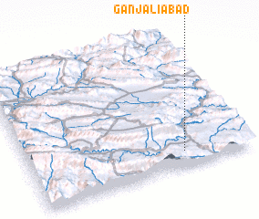 Places with similar names to Ganj‘alīābād, Iran :: Disclaimer :: Information on this page comes without warranty of any kind |
||
|
Where is Ganj‘alīābād? Elevation and coordinates ::
Latitude (lat): 33°7'0"N Longitude (lon): 47°42'0"E
Elevation (approx.): 685m (map arrows pan, magnifying glasses zoom) |
||
|
Visiting Ganj‘alīābād? Hotel/Accommodation ::
Book a hotel in Ganj‘alīābād Travel Guide ::
Buy a travel guide for Iran rental cars ::
car rental offers GPS waypoint ::
download a GPX waypoint (PoI) of Ganj‘alīābād for your GPS receiver
|
||