|
search place name
|
||
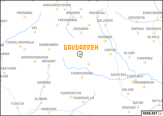
Gāv Darreh (Kordestān, Iran)Gāv Darreh is a town in the Kordestān region of Iran. An overview map of the region around Gāv Darreh is displayed below.
regional and 3d topo map of Gāv Darreh, Iran ::
Gāv Darreh airports ::
The nearest airport is SDG - Sanandaj, located 32.9 km south east of Gāv Darreh.
Other airports nearby include KSH - Bakhtaran Shahid Ashrafi Esfahani (131.5 km south), Nearby towns ::
Qolqoleh-ye Chatān (1.9km south east) //
Tūdār-e Şamadī (4.4km south) //
Zardābād (5.8km north) //
Mo‘īnābād (5.9km north east) //
Khāk Rūzī (5.9km north east) //
Chatān (5.5km east) //
Barūdar (6.3km west) //
Shaqeh Bard (6.5km west) //
Kānī Tāleh (7.8km north) //
Farhādābād (8.3km north) //
Qalvazeh (8.8km north east) //
Khanjareh-ye Bālā (8.9km north west) //
Doveyseh (8.4km south east) //
Ganehbū (9.6km south west) //
[all distances 'as the bird flies' and approximate] 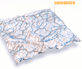 Places with similar names to Gāv Darreh, Iran ::
// Gövdǝrǝ (AZ)
// Kavdar (AZ)
// Cova da Iria (PT)
// Cova do Ouro (PT)
// Kvedarai (LT)
// Čavdari (BA)
// Çavdar (TR)
// Çavdar (TR)
// Çavdar (TR)
// Çavdar (TR)
Disclaimer :: Information on this page comes without warranty of any kind |
||
|
Where is Gāv Darreh? Elevation and coordinates ::
Latitude (lat): 35°29'52"N Longitude (lon): 46°49'4"E
Elevation (approx.): 1903m (map arrows pan, magnifying glasses zoom) |
||
|
Visiting Gāv Darreh? Hotel/Accommodation ::
Book a hotel in Gāv Darreh Travel Guide ::
Buy a travel guide for Iran rental cars ::
car rental offers GPS waypoint ::
download a GPX waypoint (PoI) of Gāv Darreh for your GPS receiver
|
||