|
search place name
|
||
Gāvkān-e Bāgh (Kermān, Iran)Gāvkān-e Bāgh is a town in the Kermān region of Iran. An overview map of the region around Gāvkān-e Bāgh is displayed below.
regional and 3d topo map of Gāvkān-e Bāgh, Iran ::

Gāvkān-e Bāgh airports ::
The nearest airport is KER - Kerman, located 170.8 km north west of Gāvkān-e Bāgh.
Other airports nearby include BND - Bandar Abbass Intl (245.0 km south west), Nearby towns ::
Mehregān (0.4km east) //
Kesht Kārān (0.5km north west) //
Anār Shīrīn (0.6km west) //
Gāvkān (0.7km west) //
Sartangū'īyeh (0.8km south west) //
Shūganzū (0.8km south east) //
‘Aliābād (1.0km south east) //
Deh Now (1.3km south) //
Dorūghgū'īyeh (1.3km north east) //
Dar Zangū'īyeh (1.6km south) //
Pāgodār-e Maskūn (1.5km north east) //
Bāgh Baghal (1.6km north east) //
Gāvkān-e Gūrān (1.6km north west) //
Chenārū'īyeh (1.6km north west) //
Kahnūj (1.7km south east) //
Amīrābād (2.1km south) //
Āb Donbāl (2.0km north east) //
Sar Shūr (2.1km south east) //
Gūr-e Bīzhan (2.2km south west) //
Bāgh Zahrā (2.3km south) //
Torshū'īyeh-ye Pā'īn (2.2km east) //
Torshū'īyeh-ye Bālā (2.2km east) //
Sarcheshmeh (2.6km south) //
Sar Band-e Maskūn (2.6km south west) //
Sar Mūrān (2.7km south) //
Germorīdān (2.8km south west) //
Dartīk (2.8km south west) //
Dar Rīgān (2.8km south west) //
Bāgh-e Bāshū (2.8km south west) //
[all distances 'as the bird flies' and approximate] 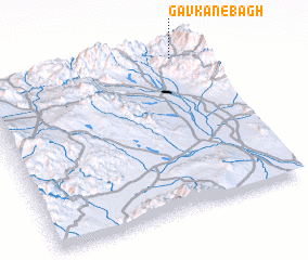 Places with similar names to Gāvkān-e Bāgh, Iran :: Disclaimer :: Information on this page comes without warranty of any kind |
||
|
Where is Gāvkān-e Bāgh? Elevation and coordinates ::
Latitude (lat): 28°58'22"N Longitude (lon): 57°53'42"E
Elevation (approx.): 2200m (map arrows pan, magnifying glasses zoom) |
||
|
Visiting Gāvkān-e Bāgh? Hotel/Accommodation ::
Book a hotel in Gāvkān-e Bāgh Travel Guide ::
Buy a travel guide for Iran rental cars ::
car rental offers GPS waypoint ::
download a GPX waypoint (PoI) of Gāvkān-e Bāgh for your GPS receiver
|
||