|
search place name
|
||
Gāvkosh (Kermān, Iran)Gāvkosh is a town in the Kermān region of Iran. An overview map of the region around Gāvkosh is displayed below.
regional and 3d topo map of Gāvkosh, Iran ::

Gāvkosh airports ::
The nearest airport is KER - Kerman, located 192.6 km north west of Gāvkosh.
Other airports nearby include BND - Bandar Abbass Intl (237.3 km south west), Nearby towns ::
Jūnak (1.4km east) //
Tūmānū (1.7km south east) //
Tūt (2.0km west) //
Gelū Jūī (3.2km north west) //
Kesht (4.4km south west) //
Anār Dokhtarān (4.8km north west) //
Gerdīn (5.4km north west) //
Kal Kūhī (5.6km west) //
Khvod Khārān (5.7km west) //
Patanhā (6.6km north west) //
Rūmīn (6.5km north east) //
Rad Kūh (6.7km south west) //
Dūmār-e Bālā (6.2km north west) //
Kenzerk (6.7km north west) //
Kāvestān (6.5km west) //
Komīn (7.1km north east) //
Dūmār-e Pā'īn (6.8km west) //
Pīdengū'īyeh (6.8km west) //
Shesh Tak (7.2km south east) //
Kal Sang (7.3km south east) //
‘Alī Morādī (7.6km north west) //
Dar-e Bord (7.6km north west) //
Kashkū'īyeh (7.3km north west) //
Jūr Haft (8.1km south) //
Jam‘ (8.1km south east) //
Sar Now (7.8km north west) //
Chahār Dīvār (7.8km north west) //
Sībak-e Sūrān (7.9km south west) //
Temenū'īyeh (8.3km south east) //
[all distances 'as the bird flies' and approximate] 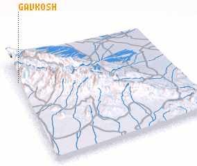 Places with similar names to Gāvkosh, Iran ::
Disclaimer :: Information on this page comes without warranty of any kind |
||
|
Where is Gāvkosh? Elevation and coordinates ::
Latitude (lat): 28°48'2"N Longitude (lon): 58°0'15"E
Elevation (approx.): 2686m (map arrows pan, magnifying glasses zoom) |
||
|
Visiting Gāvkosh? Hotel/Accommodation ::
Book a hotel in Gāvkosh Travel Guide ::
Buy a travel guide for Iran rental cars ::
car rental offers GPS waypoint ::
download a GPX waypoint (PoI) of Gāvkosh for your GPS receiver
|
||