|
search place name
|
||
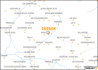
Gerdeh (Iran)Gerdeh is a town in Iran. An overview map of the region around Gerdeh is displayed below.
regional and 3d topo map of Gerdeh, Iran ::
Gerdeh airports ::
The nearest airport is RAS - Rasht, located 163.8 km south east of Gerdeh.
Nearby towns ::
Ūranj (1.5km west) //
Āq Dāshī (3.7km south) //
Novashnaq (4.0km south) //
Tappeh (4.7km south west) //
‘Anbarān (5.0km north east) //
‘Anbarān-e Bālā (5.6km north) //
Joleh Karān (4.7km south west) //
Kūlān Daraq-e Bālā (5.7km north) //
‘Anbarān-e Pāʼīn (5.7km north) //
Qeshlāq Chāy (4.7km south east) //
Kūlān Daraq-e Pā'īn (6.3km north west) //
Shūr Gel (6.3km south west) //
Āq Zamān Kandī (6.3km south west) //
Solūţ (6.3km south east) //
Yājlū (6.1km west) //
Qeshlāq-e Sarābād (7.6km north) //
Mīrzānaq (6.9km north west) //
Amīn Jān (8.0km north) //
Yeznābād (8.0km south west) //
Khānqāh-e Pā'īn (8.0km south west) //
‘Alī Kamar (9.4km north west) //
‘Alī Bolāghī (9.4km south west) //
[all distances 'as the bird flies' and approximate] 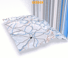 Places with similar names to Gerdeh, Iran ::
Disclaimer :: Information on this page comes without warranty of any kind |
||
|
Where is Gerdeh? Elevation and coordinates ::
Latitude (lat): 38°27'0"N Longitude (lon): 48°24'0"E
Elevation (approx.): 1442m (map arrows pan, magnifying glasses zoom) |
||
|
Visiting Gerdeh? Hotel/Accommodation ::
Book a hotel in Gerdeh Travel Guide ::
Buy a travel guide for Iran rental cars ::
car rental offers GPS waypoint ::
download a GPX waypoint (PoI) of Gerdeh for your GPS receiver
|
||