|
search place name
|
||
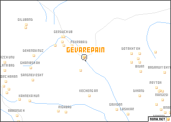
Gevar-e Pa'īn (Kermān, Iran)Gevar-e Pa'īn is a town in the Kermān region of Iran. An overview map of the region around Gevar-e Pa'īn is displayed below.
regional and 3d topo map of Gevar-e Pa'īn, Iran ::
Gevar-e Pa'īn airports ::
The nearest airport is KER - Kerman, located 142.8 km north west of Gevar-e Pa'īn.
Other airports nearby include BND - Bandar Abbass Intl (252.6 km south west), Nearby towns ::
Gevar-e Bālā (1.1km north) //
Boneh Bozorg (2.3km south west) //
Khīār (2.3km south west) //
Fekrābād (3.2km north) //
Zereshk (4.3km north west) //
Bīd Zāgh (5.4km north west) //
Dūkestān (6.0km north west) //
Gerdū Chūb (6.7km north west) //
Do Del (6.7km north west) //
Deh Nowrūz (6.9km north west) //
Jūshīn (6.7km north west) //
Kechengān (7.7km south) //
[all distances 'as the bird flies' and approximate]  Places with similar names to Gevar-e Pa'īn, Iran ::
// Gīvar-e Pā'īn (IR)
Disclaimer :: Information on this page comes without warranty of any kind |
||
|
Where is Gevar-e Pa'īn? Elevation and coordinates ::
Latitude (lat): 29°10'8"N Longitude (lon): 57°42'34"E
Elevation (approx.): 2227m (map arrows pan, magnifying glasses zoom) |
||
|
Visiting Gevar-e Pa'īn? Hotel/Accommodation ::
Book a hotel in Gevar-e Pa'īn Travel Guide ::
Buy a travel guide for Iran rental cars ::
car rental offers GPS waypoint ::
download a GPX waypoint (PoI) of Gevar-e Pa'īn for your GPS receiver
|
||