|
search place name
|
||
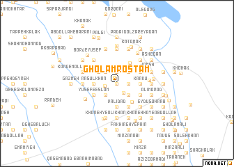
Gholām Rostam (Sīstān va Balūchestān, Iran)Gholām Rostam is a town in the Sīstān va Balūchestān region of Iran. An overview map of the region around Gholām Rostam is displayed below.
regional and 3d topo map of Gholām Rostam, Iran ::
Gholām Rostam airports ::
The nearest airport is ZAH - Zahedan Intl, located 203.0 km south west of Gholām Rostam.
Nearby towns ::
Fakhīreh-ye Bālā (0.0km north) //
Mārgān (1.7km south east) //
Chakkol (1.6km east) //
Namrūdī (1.9km north) //
Takor (1.9km north) //
Mollā Goljān (1.7km west) //
Karam (2.4km north east) //
Gol-e Mīr Karam (2.4km north west) //
Golzār-e Nowrūz (2.4km north west) //
Kachkūl (2.4km south east) //
Malang-e Ḩasan (2.4km south east) //
Ḩoseyn-e Şafdar (2.4km south east) //
Kartak (2.4km south east) //
Ḩoseyn-e Shahsavār (2.4km south west) //
Deh-e Gīāmā (3.1km north west) //
Karkū (3.2km east) //
Karīm Koshteh (3.2km east) //
Rasūl Khān (3.2km west) //
Valī Dād (3.7km south) //
Ḩājjī Morād (3.7km south) //
Deh-e ‘Alī Gorgī (3.6km south east) //
Takhteh Pol (3.8km north east) //
Ḩoseyn Pakīr (3.7km north east) //
Dād Shāh (3.7km north east) //
Gol Moḩammad (3.7km north east) //
Galah Chāh (3.7km north east) //
‘Alī Khān-e Kachkūl (3.7km south east) //
Dūst Moḩammad-e Lashkarān (3.7km south east) //
‘Alī Akbar-e Khammar (4.0km south east) //
[all distances 'as the bird flies' and approximate] 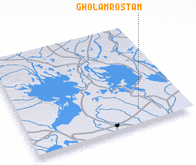 Places with similar names to Gholām Rostam, Iran :: Disclaimer :: Information on this page comes without warranty of any kind |
||
|
Where is Gholām Rostam? Elevation and coordinates ::
Latitude (lat): 31°10'0"N Longitude (lon): 61°43'0"E
Elevation (approx.): 483m (map arrows pan, magnifying glasses zoom) |
||
|
Visiting Gholām Rostam? Hotel/Accommodation ::
Book a hotel in Gholām Rostam Travel Guide ::
Buy a travel guide for Iran rental cars ::
car rental offers GPS waypoint ::
download a GPX waypoint (PoI) of Gholām Rostam for your GPS receiver
|
||