|
search place name
|
||
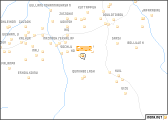
Ghūr (Iran)Ghūr is a town in Iran. An overview map of the region around Ghūr is displayed below.
regional and 3d topo map of Ghūr, Iran ::
Ghūr airports ::
The nearest airport is TBZ - Tabriz Intl, located 123.0 km west of Ghūr.
Other airports nearby include RAS - Rasht (207.8 km south east), Nearby towns ::
Majandeh (1.2km north west) //
‘Ūr (2.4km north east) //
Qerkh Bolāgh (3.7km south) //
Āgh Bolāgh (4.1km south) //
Ḩeşār (3.4km north west) //
Sāchlū (3.4km north west) //
Andazaq (4.2km west) //
Aḩmadābād (5.2km north west) //
Valehzīr (5.3km south east) //
Ḩīq (6.3km north west) //
Mazra‘eh-ye Khalaf (5.7km north west) //
Ālūch (5.7km north west) //
Khvorshīdābād (5.9km north west) //
Khorramābād (7.4km north) //
Sardī (6.9km north east) //
Dakesh (8.0km north) //
Kharāvān (6.9km north west) //
Mū'īl (7.0km south east) //
Naşīrābād (7.5km south east) //
Khīāv (8.9km north east) //
Meshgīn Shahr (9.0km north east) //
Mīvar (8.0km south east) //
Qarah Darvīsh (9.4km north east) //
Aḩmad Beyglū (10.2km north west) //
[all distances 'as the bird flies' and approximate] 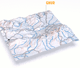 Places with similar names to Ghūr, Iran ::
Disclaimer :: Information on this page comes without warranty of any kind |
||
|
Where is Ghūr? Elevation and coordinates ::
Latitude (lat): 38°20'0"N Longitude (lon): 47°37'0"E
Elevation (approx.): 1669m (map arrows pan, magnifying glasses zoom) |
||
|
Visiting Ghūr? Hotel/Accommodation ::
Book a hotel in Ghūr Travel Guide ::
Buy a travel guide for Iran rental cars ::
car rental offers GPS waypoint ::
download a GPX waypoint (PoI) of Ghūr for your GPS receiver
|
||