|
search place name
|
||
Haft Pāreh (Fārs, Iran)Haft Pāreh is a town in the Fārs region of Iran. An overview map of the region around Haft Pāreh is displayed below.
regional and 3d topo map of Haft Pāreh, Iran ::

Haft Pāreh airports ::
The nearest airport is SYZ - Shiraz Shahid Dastghaib Intl, located 101.4 km east of Haft Pāreh.
Other airports nearby include BUZ - Bushehr (116.7 km south west), Nearby towns ::
Shāh Salţaneh (1.0km west) //
Ḩājjīābād (1.1km south east) //
Shāpūr (1.2km south west) //
Panj Maḩal (1.4km south west) //
‘Amū'ī (1.7km north) //
Zarābād (2.0km south) //
Sheykhī (2.5km south east) //
Sāsān (2.5km north east) //
Tang-e Chowgān-e Pā'īn (2.6km north east) //
Gachkharān (3.0km south) //
Rashnābād (2.6km west) //
Tall-e Kūshk (2.9km north west) //
Seyyed Ḩoseyn (3.4km north) //
Darreh-ye Sag Koshteh (3.0km west) //
Ḩakīm Bāshī-ye Bālā (3.2km north west) //
Būgarā (3.4km south west) //
Tall Kūhak (3.9km south west) //
Korūnī (4.0km south) //
Bīshāpūr (4.1km south) //
Kashkūlī (3.8km north east) //
Tang-e Chowgān-e Mīānī (4.0km north east) //
Ganjeh'ī (4.5km north) //
Anārestān (4.1km west) //
Ḩakīm Bāshī-ye Pā'īn (4.1km west) //
Borj Sūkhteh-ye Pā'īn (4.6km south west) //
Khodāābād (5.1km south) //
Ja‘farābād (4.9km south west) //
Şamadābād (5.5km south) //
Tang-e Chowgān-e Bālā (5.1km north east) //
[all distances 'as the bird flies' and approximate] 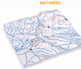 Places with similar names to Haft Pāreh, Iran ::
// Havātpur (PK)
Disclaimer :: Information on this page comes without warranty of any kind |
||
|
Where is Haft Pāreh? Elevation and coordinates ::
Latitude (lat): 29°46'21"N Longitude (lon): 51°34'36"E
Elevation (approx.): 807m (map arrows pan, magnifying glasses zoom) |
||
|
Visiting Haft Pāreh? Hotel/Accommodation ::
Book a hotel in Haft Pāreh Travel Guide ::
Buy a travel guide for Iran rental cars ::
car rental offers GPS waypoint ::
download a GPX waypoint (PoI) of Haft Pāreh for your GPS receiver
|
||